
Yo soy un humilde Geógrafo, además soy alguien curioso al que no le importa meterme en mil fregados por las razones más variadas, que ha trabajado y trabaja como tal pero también como diseñador, como fotógrafo o como comercial. He trabajado con obreros, con arquitectos, porteros de fincas, con dibujantes, con consultores de todos losContinue reading “Consultoría e ideología: Manual de estupidez”
Category Archives: Modelado 3D
NO AL PELOTAZO DE LA ERMITA DEL SANTO

Esta semana pasada he estado colaborando puntualmente con la Plataforma “planermitadelsanto”, vecinos como yo que se han (nos hemos) organizado para echar abajo un plan de recalificación urbanística que no es ni mucho menos del interés general. He preparado para ellos algunos mapas en 3D (georeferenciando planos, extruyendo manualmente usando datos del Plan propuesto, realizandoContinue reading “NO AL PELOTAZO DE LA ERMITA DEL SANTO“
Wildfires in the sub-Saharan region

This image, acquired by one of the Copernicus Sentinel-2 on 8 February 2022, shows ongoing wildfires in the Boma National Park in South Sudan. Fires are common at this time of year in the sub-Saharan region.
Peña Muñana en Cadalso de los Vidrios
Febrero 2022. Zona de Peña Muñana en Término Municipal de Cadalso de los Vidrios, en Madrid, España. Fly-through semi-automático realizado con el software GLOBAL MAPPER V23.0. Fuentes: TIF Raster grid de LIDAR 2m (PNOA) descargado desde el CNIG e imágenes de alta resolución World Imagery (desarrollado abajo).
El láser desvela toda la grandeza de la civilización maya (Fuente: El País)
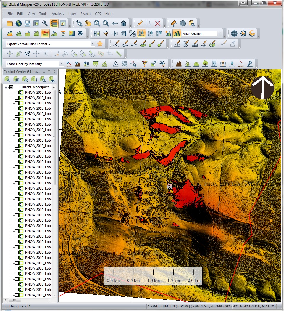
Esta mañana encontré este interesante reportaje sobre el LIDAR (Laser Imaging Detection and Ranging, detección y localización de imágenes por láser) la tecnología con la que trabajo desde hace años y que a algunos les parece recién inventada, jeje.
LIDAR Madrid LAZ 20cm

Ya van varias veces en el último mes que alguien no especialista en temas geográficos-cartográficos me habla de ‘ese sistema’ de láser para saber ‘la altura del terreno’ y es que la verdad es que LIDAR parece magia. Es bastante increible que pase un avión con una tecnología invisible a ojos humanos y que seContinue reading “LIDAR Madrid LAZ 20cm”
Comparación de DTM usando Global Mapper 17.0.1

Comparar, primero visualmente y después cuantitativamente dos DTM. Por un lado elegimos una fuente muy usual, SRTM con un DTM derivado de Fotogrametría Stereo.
Descargas del CNIG. Open Source bien hecho!

Hola amigos del GIS, Por motivos de trabajo que no vienen al caso, he tenido que bucear de manera sistemática la web de descargas del CNIG. http://centrodedescargas.cnig.es/CentroDescargas/inicio.do Una maravilla. Por motivos que tampoco viene al caso, he de hacer esto mismo de vez en cuando en todos los Institutos cartográficos del mundo y el delContinue reading “Descargas del CNIG. Open Source bien hecho!”
Risk exposure. Geoprocessing using Open Source Data!! Next steps!!
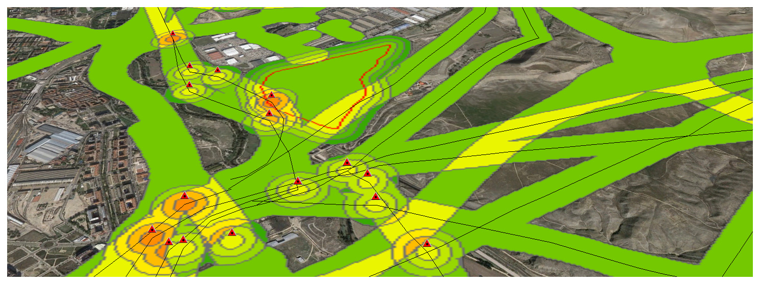
Now that we have completed a first example, let’s continue with a real-world one. Its important working on a Data Model to define what we understand as a Risk and how important this is. Meaning. High voltage power lines are an actual risk but the closer we are, i guess the bigger the risk is, meaning i.e 3 if we are within 50m and 1 if we are 150m away… It’s only a guess.
Change detection – Detección de cambios en polígonos
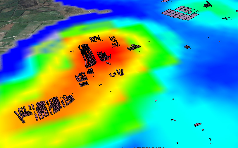
THE PROCEDURE: Centroids of buildings; Spatial join showing presence-absence, considering a 10m accuracy threshold, meaning if the centroid has not moved more than 10m, its the same building. If the centroid in 2012 is not in 2014, its considered as demolished. If a new centroid appears its considered new building.

