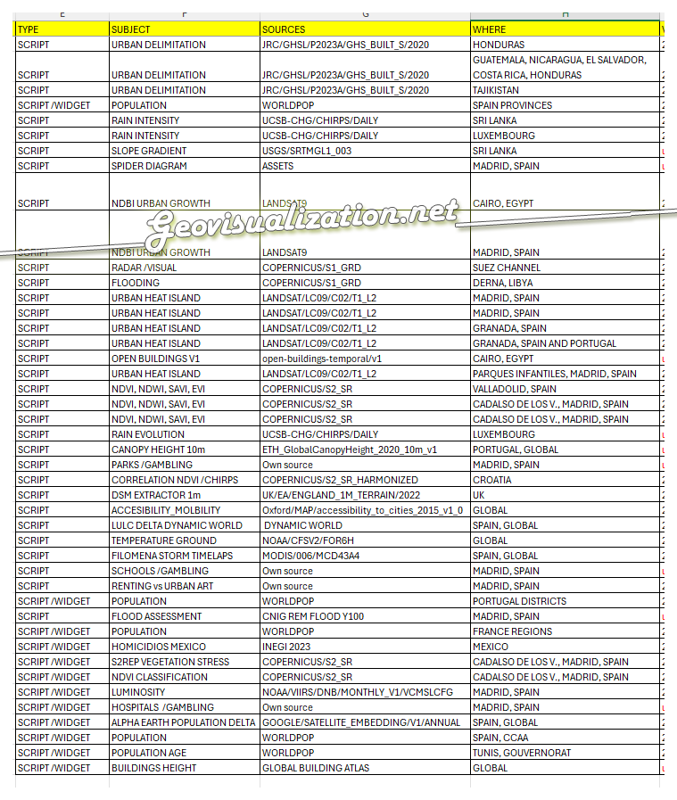
Google Earth Engine (GEE) combined with JavaScript provides a powerful environment for large-scale geospatial analysis directly in the cloud. Using the GEE JavaScript API, it is possible to process and visualize massive Earth observation datasets efficiently, without the need for local infrastructure or heavy preprocessing workflows.
JavaScript in GEE enables the creation of reproducible scripts that automate complex tasks such as image filtering, temporal analysis, and the computation of spectral indices like NDVI, EVI, or NDWI. These scripts can be easily adapted to different regions or scales, making them highly versatile for both research and applied projects.
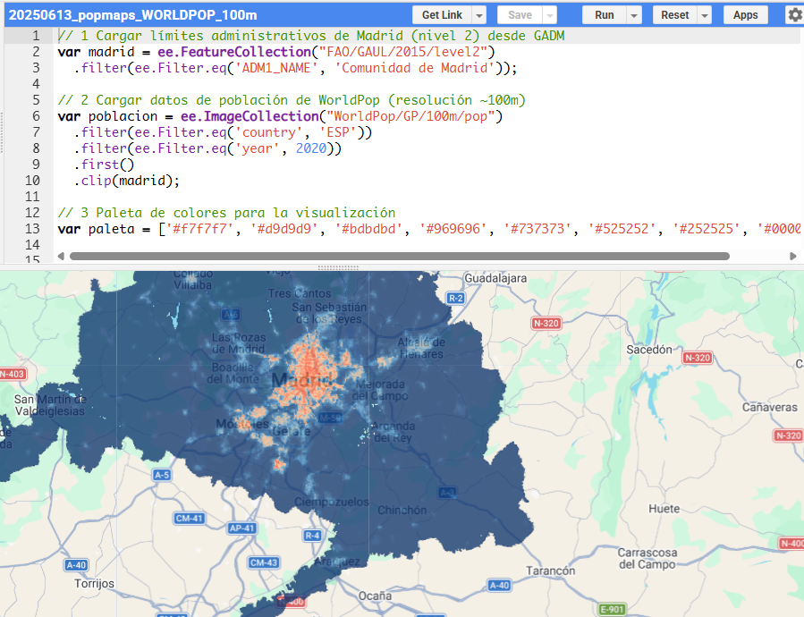
Beyond scripting, GEE also allows the development of interactive applications through its built-in UI framework. These apps can integrate maps, charts, and user controls, transforming raw geospatial data into intuitive tools for exploration and decision-making.
Examples of this approach include wildfire monitoring using Sentinel-2 imagery with different band combinations, flood detection using radar data, and urban or environmental analyses such as the visualization of changes in areas like Madrid Río. These use cases demonstrate how satellite data can be translated into meaningful insights in near real time.
By combining JavaScript with GEE, it is possible to bridge the gap between data processing and visualization, building end-to-end workflows that range from simple exploratory scripts to fully functional geospatial applications.
Are you interested in scripting your own idea in Javascript?. Don’t hesitate to contact me.
You can request your own demo here!
Alberto C.
GIS Analyst
