The USGS LiDAR Explorer, hosted via gishub.org, serves as a high-performance web gateway for interacting with the USGS 3D Elevation Program (3DEP) datasets. First thing, go to this GITHUB repository https://github.com/opengeos/maplibre-gl-usgs-lidar, download code for the project (code>download ZIP), get connected with RStudio, save new project and open a script window… It’s all set up!
Tag Archives: lidar
The beauty (and precision) of LIDAR:

Lidar, which stands for Light Detection and Ranging, is a technology that uses laser beams to measure distances and create detailed maps of the surrounding environment. It works by emitting laser pulses and then measuring the time it takes for the pulses to bounce back after hitting objects in their path. By analyzing the returning signals, lidar can accurately calculate the distance to various points and generate a three-dimensional map.
El láser desvela toda la grandeza de la civilización maya (Fuente: El País)
Esta mañana encontré este interesante reportaje sobre el LIDAR (Laser Imaging Detection and Ranging, detección y localización de imágenes por láser) la tecnología con la que trabajo desde hace años y que a algunos les parece recién inventada, jeje.
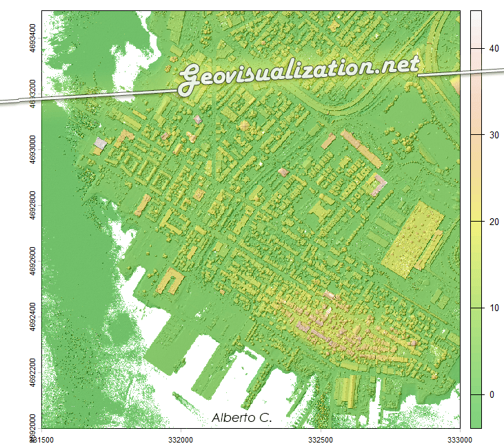
LIDAR Madrid LAZ 20cm

Ya van varias veces en el último mes que alguien no especialista en temas geográficos-cartográficos me habla de ‘ese sistema’ de láser para saber ‘la altura del terreno’ y es que la verdad es que LIDAR parece magia. Es bastante increible que pase un avión con una tecnología invisible a ojos humanos y que seContinue reading “LIDAR Madrid LAZ 20cm”
Descargas del CNIG. Open Source bien hecho!

Hola amigos del GIS, Por motivos de trabajo que no vienen al caso, he tenido que bucear de manera sistemática la web de descargas del CNIG. http://centrodedescargas.cnig.es/CentroDescargas/inicio.do Una maravilla. Por motivos que tampoco viene al caso, he de hacer esto mismo de vez en cuando en todos los Institutos cartográficos del mundo y el delContinue reading “Descargas del CNIG. Open Source bien hecho!”
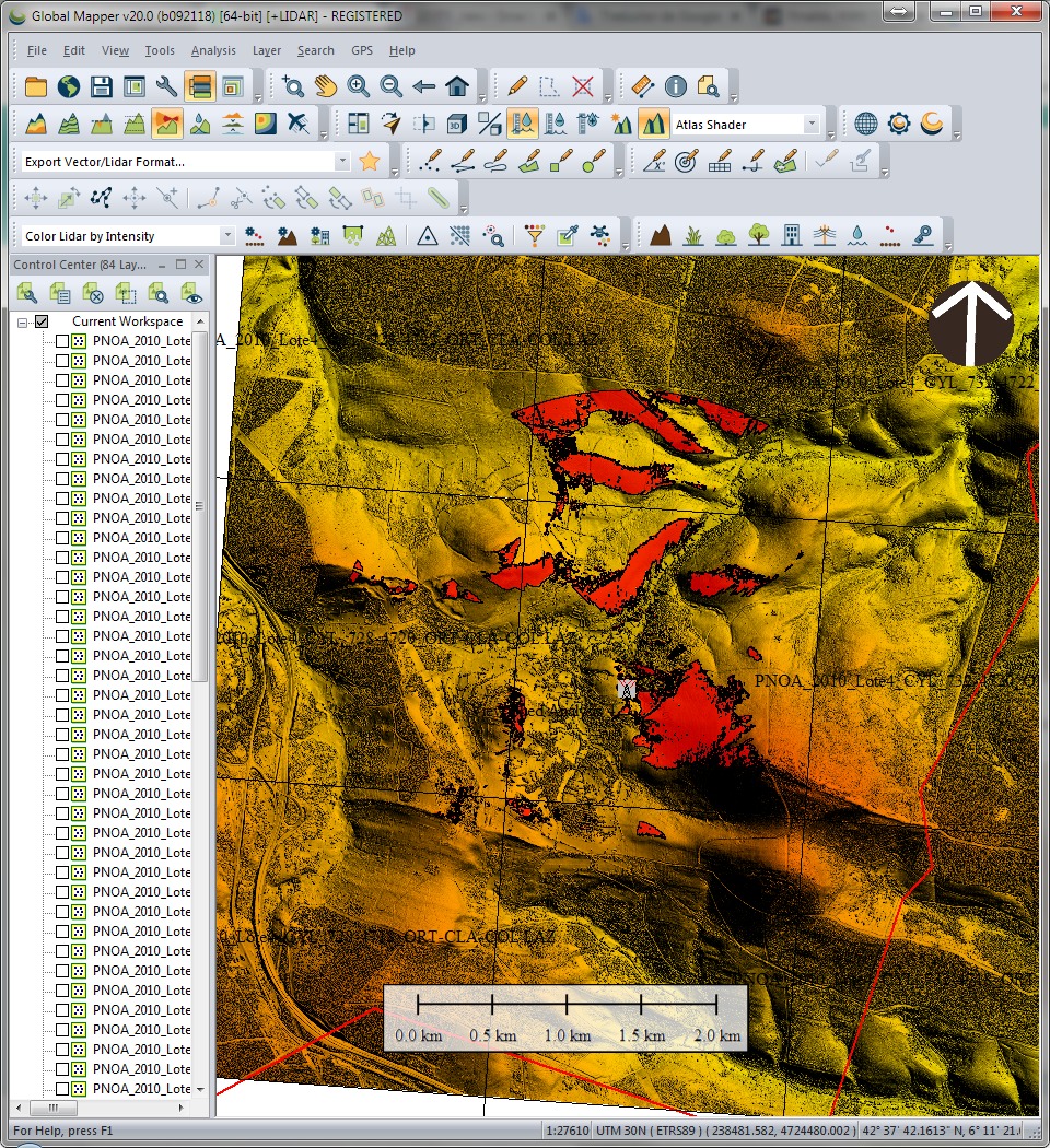
RSME comparing LIDAR data with a third party’s 3D dataset
I would like to share with you an easy analysis i have been working in the last days. I had a vector dataset of buildings and i knew how high they were (there was a field called ‘AGL’ or Above Ground Level) and a LIDAR 2m resolution dataset over the city of London. My aimContinue reading “RSME comparing LIDAR data with a third party’s 3D dataset”
Visualizing LAS LIDAR data with sketch-up
While trying to figure out the way to get a 3D model from raw Lidar data, I first opened my LAS file in Global Mapper, exported it to DXF, imported then into Sketch-up and after recording a few scenes, I saved the animation… this is it!. Alberto
Using Excel to calculate the RMSE for LiDAR vertical ground control points

The height accuracy of the collected LiDAR data can be verified by comparing with independently surveyed ground control points on hard, flat, open surfaces. It is essentially just calculating the height differences for all the control points and then determining the height root mean squared error (RMSE) or differences. Most LiDAR processing software have the reporting function built-in. However, plain Microsoft Excel can also do the job (except for extracting the elevation from the LiDAR data).
