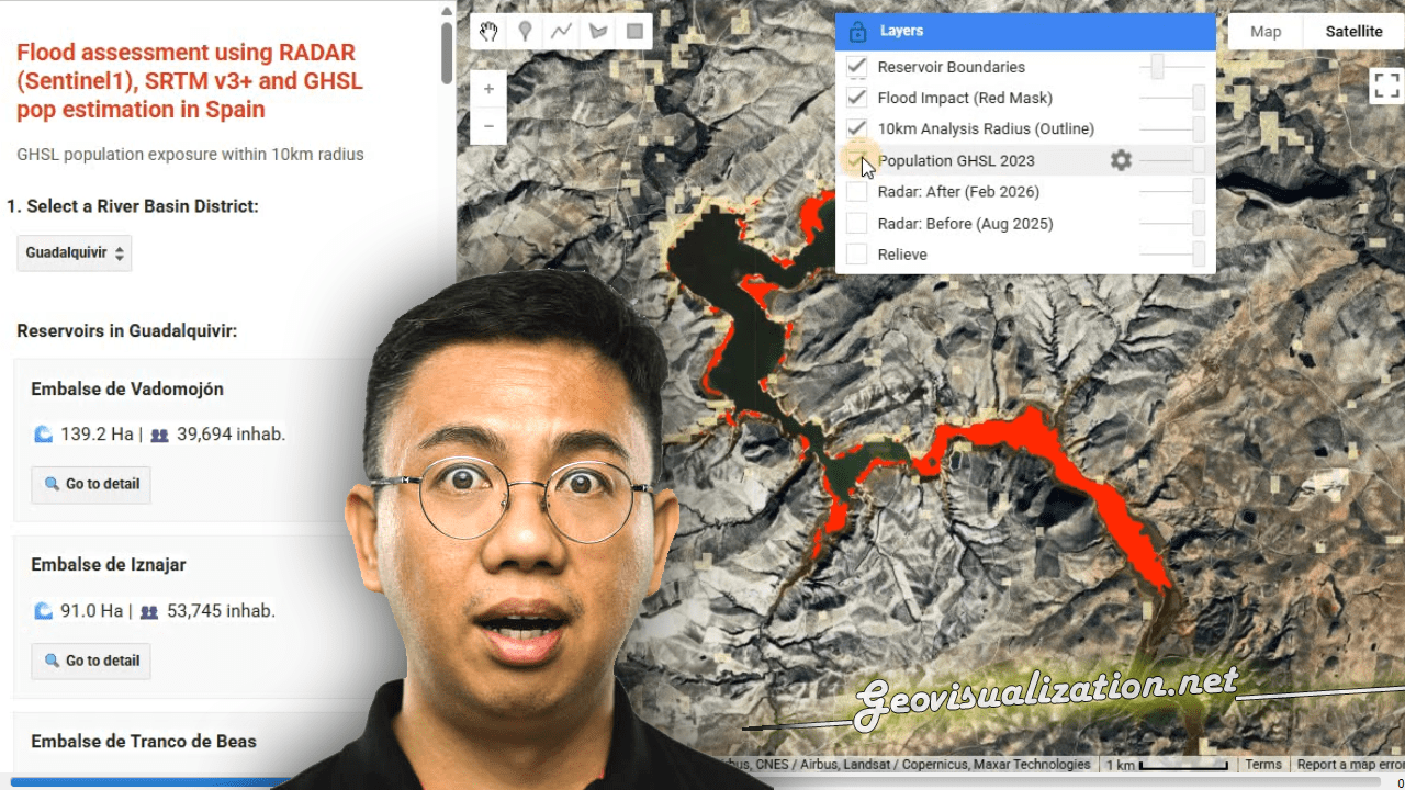
Comparación de DTM usando Global Mapper 17.0.1

Comparar, primero visualmente y después cuantitativamente dos DTM. Por un lado elegimos una fuente muy usual, SRTM con un DTM derivado de Fotogrametría Stereo.

DTM validation using Google Earth (and RMSE extraction)

Hi guys, Surfing the internet is great when you need to figure out something. I needed to validate some DTM from unknown sources against an also unknown source (but at least a kind of reliable one, Google Earth). All we need is Google Earth TCX converter ARcGIS Excel This is the procedure i have followed:Continue reading “DTM validation using Google Earth (and RMSE extraction)”

HTML High resolution DTM visualization using Quantum GIS (Qgis)

This QGIS Plugin, Qgis2threejs, exports terrain data, map canvas image and vector data to your web browser!! All you have to do is opening the DTM in Qgis (2.4.0 Chugiak), go to plugins library and install Qgis2threejs. Once its installed you will see this icon on screen and you will need to clic on it. Then choosingContinue reading “HTML High resolution DTM visualization using Quantum GIS (Qgis)”

DTM from SRTM? Let’s compare sources using RMSE (Root Mean Square Error) and a gaussian kernell density map

I guess we all can make a DTM out of many sources but SRTM is one of the most common ones, right?. Then let’s learn from this very simple approach how close we are from the SRTM raw data. Selecting a not very big representative area to be able to handle it, exporting raster to polygon (fromContinue reading “DTM from SRTM? Let’s compare sources using RMSE (Root Mean Square Error) and a gaussian kernell density map”