
All existing buildings in Madrid currently listed in the Land Registry database have their year of construction recorded. This map shows, by decade, where the bulk of that urban development took place. For example, in the 1920s it was in the Salamanca district, in the 1930s in Chamartín… shifting from development in the city centre to the outskirts.
Tag Archives: Photoshop
Aventuras y desventuras de un geógrafo en “desarrollo”

La cartografía siempre ha sido un oficio de precisión, paciencia y criterio espacial. Durante años, el flujo de trabajo de cualquier geógrafo pasaba inevitablemente por entornos de escritorio como ArcGIS Pro o QGIS: cargar capas, ajustar simbología, exportar mapas. Herramientas sólidas, probadas, indispensables. Pero algo está cambiando.
Cada vez más, el análisis espacial ocurre en la nube, en navegadores, en entornos de código. En anteriores post habéis visto algunos test/ideas/aplicaciones que he desarrollado con Javascript Google Earth Engine, que procesa imágenes satelitales a escala planetaria sin mover un solo archivo. Deck.gl y Maplibre renderizan millones de puntos en 3D directamente en el navegador. React convierte un mapa en una aplicación interactiva con pocas líneas de código.
Testing GEMINI for 3D environments. From SketchUp to an unlikely future!
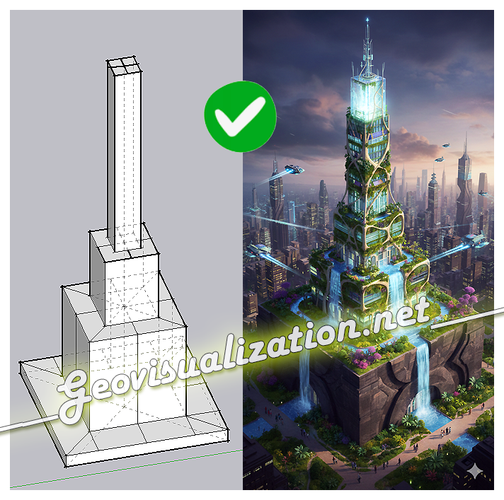
The exercise shows how a simple SketchUp 3D volume, defined solely by its basic geometry, can be transformed into a complex architectural proposal. Starting from the initial schematic model, the system interprets proportions, levels, and shapes, and converts them into a fully developed building, complete with textures, vegetation, lighting, and an urban context
Cool data. What is this?
What is this ‘cool data‘ all about?. When i got my degree in Geography (about 15 years ago) it didn’t make sense at all being interested in something like graphic design, photography, video and all this stuff… but not only interested in my leisure time but also for taking advantage of it, getting a lifeContinue reading “Cool data. What is this?”
Solar + Shadows analysis on Rue Massillon, Nantes (France)
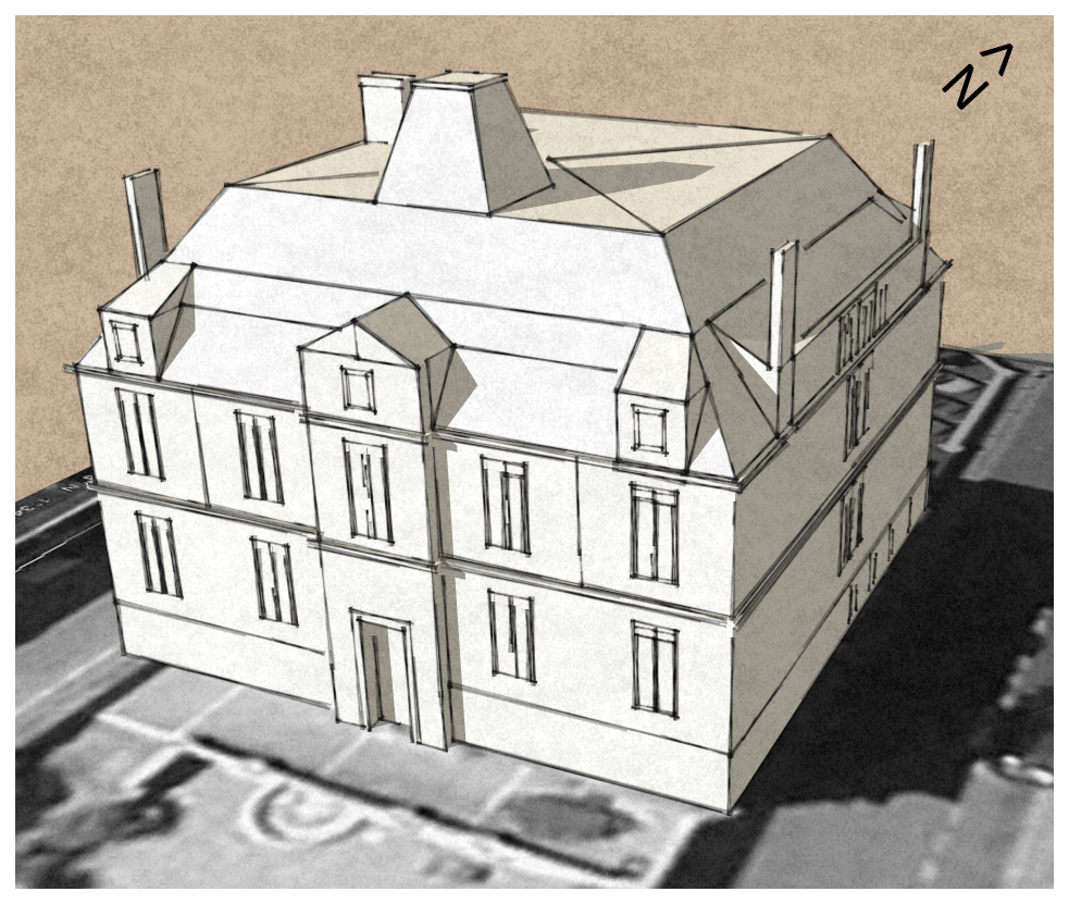
Let’s model it first using Sketchup. Also I have used a non standard style only for visualization purposes
Geovisualization, 3D models and more!
Here you will be able to see some of my latest 3D stuff… A compilation of 3D models, flythroughs and graphic resuorces available… All you need regarding 3D scenarios (heights datasets, satellite imagery and 3D models) and Video Edition… Are you guys thinking about doing something like this?. Please contact me. Alberto C. BA GeographyContinue reading “Geovisualization, 3D models and more!”
More of my 3D video edited scenarios.
Please, dont forget to turn on your speakers. Even if i first used a different score and Youtube’s elfs told me not to use it (because of copyright authoring) I have chosen this music from their stuff and this is what I finally got… Hope you like it. Alberto BA Geography MSc GIS and RemoteContinue reading “More of my 3D video edited scenarios.”
Some of my 3D scenarios
Barcelona (Spain), Winnipeg (Canada), Las Vegas (USA), Moscow (Russia), Durban (South Africa), Vancouver (Canada) and Tokyo (Japan)… these were some of my Terrain view’s 3D scenarios published by Computamaps, a South African company I worked in not so long ago. By the way it was one of my best professional experiences ever… I enjoyed joiningContinue reading “Some of my 3D scenarios”
One more 3D building in Avenida de la Vega. Restaurante Asiático SHENG. Madrid, Spain.
I used to have lunch every thrusday there, at the ‘Restaurante Asiático SHENG’. I strongly recommend you ‘entremeses’ (In China you will find them as ‘dim-sum’) and Cantonese duck or Hong Kong duck (this was slightly spicy thou). Very good food, very fast service and pretty cheap menu: 10,7 €… ideal for an IT worker!. TheseContinue reading “One more 3D building in Avenida de la Vega. Restaurante Asiático SHENG. Madrid, Spain.”
Vicalvaro Buildings 3D. Madrid, Spain.
And Now I would like to add one more set of buildings around my house. This is a block of flats in Vicálvaro, Madrid, Spain. This is supposed to be ‘Valderribas’ area… hope you like them!
