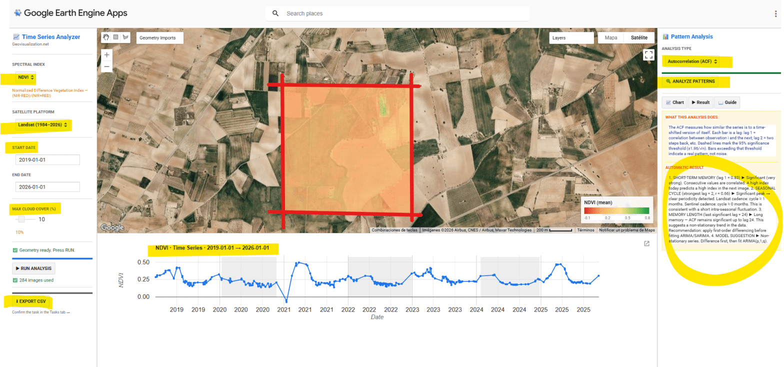
He desarrollado una aplicación interactiva en Google Earth Engine para la extracción y análisis estadístico automático de series temporales de cinco índices espectrales (NDVI, EVI, SAVI, NDWI y NBR) sobre cualquier geometría definida por el usuario en cualquier sitio del mundo. El objetivo es pasar de una imagen satélite puntual a una comprensión temporal del territorio: qué ha pasado, qué patrón subyace, y qué cabe esperar.
Tag Archives: trend
RSME comparing LIDAR data with a third party’s 3D dataset
I would like to share with you an easy analysis i have been working in the last days. I had a vector dataset of buildings and i knew how high they were (there was a field called ‘AGL’ or Above Ground Level) and a LIDAR 2m resolution dataset over the city of London. My aimContinue reading “RSME comparing LIDAR data with a third party’s 3D dataset”
