LIDAR, which stands for Light Detection and Ranging, is a technology that uses laser beams to measure distances and create detailed maps of the surrounding environment. It works by emitting laser pulses and then measuring the time it takes for the pulses to bounce back after hitting objects in their path. By analyzing the returning signals, lidar can accurately calculate the distance to various points and generate a three-dimensional map.

LIDAR is something like the quintessence of quality in mapping. It is a technology rapidly associated with accuracy and correct correspondence with reality… because it is reality!
In the field of cartography, LIDAR plays a crucial role in creating highly accurate and detailed maps. It can capture the shape and elevation of the land, including the contours of hills, valleys, and other features. This information is invaluable for urban planning, infrastructure development, and natural resource management.
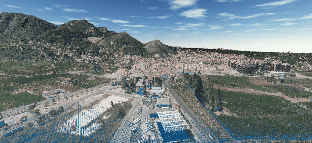
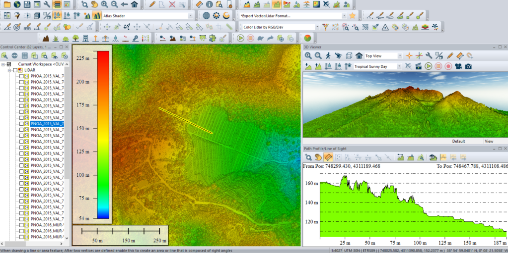
Below I show you some videos of a village in Valencia in Spain called Oliva. I would like to retire here one day, so I am looking for a good, nice and cheap plot of land for which the slope factor is very important. What better then to download recent LIDAR from the CNIG download website and geoprocess with confidence. https://centrodedescargas.cnig.es/CentroDescargas/index.jsp

LIDAR technology has also found applications in various other fields. For example, it is used in autonomous vehicles to create a real-time map of the surroundings, enabling the vehicle to navigate safely and avoid obstacles. LIDAR is also employed in forestry to assess tree density and monitor vegetation changes. Additionally, it has been used in archaeology to uncover hidden structures and in atmospheric research to study clouds and aerosols.
Overall, LIDAR is a versatile technology that provides accurate and detailed information about the physical environment, making it an essential tool for cartography and a wide range of other applications.
This other small video below shows a Digital Surface Model (DSM) of a small hillslope with a landslide, São Paulo State, southeastern Brazil. Data were collected by a team from University of São Paulo (USP) composed of: Grohmann, C.H., Gomes, E.B., Garcia, G.P.B., Viana, C.D., within the scope of research grant FAPESP #2016/06628-0 “Application of high-resolution digital elevation models in geology and geomorphology” (PI: Carlos H. Grohmann, IEE-USP).
Hope you guys like it,
Alberto
Senior GIS Analyst and LIDAR lover
Sources:
https://centrodedescargas.cnig.es/CentroDescargas/index.jsp
https://portal.opentopography.org/dataspace/dataset?opentopoID=OTDS.082019.32723.1
https://www.youtube.com/watch?v=4ivk4y8U3-E&ab_channel=EquatorStudios
