A few more lines for leting you know again that i passed this other course just now in Instituto Geográfico of Spain (IGN). Remote Sensing, Photogrammetry, Lidar and Landuse, a comprehensive 40h update on relevant information i need tu use on a daily basis. This ‘update’ helps me to better understand what i am working with andContinue reading “Remote Sensing, Photogrammetry, Lidar and Landuse IGN Spain”
Category Archives: Modelado 3D
HTML High resolution DTM visualization using QGIS
This QGIS Plugin, Qgis2threejs, exports terrain data, map canvas image and vector data to your web browser!! All you have to do is opening the DTM in QGIS (2.4.0 Chugiak), go to plugins library and install Qgis2threejs. Once its installed you will see this icon on screen and you will need to clic on it. ThenContinue reading “HTML High resolution DTM visualization using QGIS”
RSME comparing LIDAR data with a third party’s 3D dataset
I would like to share with you an easy analysis i have been working in the last days. I had a vector dataset of buildings and i knew how high they were (there was a field called ‘AGL’ or Above Ground Level) and a LIDAR 2m resolution dataset over the city of London. My aimContinue reading “RSME comparing LIDAR data with a third party’s 3D dataset”
Analyse des emplacements réservés à la livraison sur voirie: NANTES
*Désole pour mon français, si vous voulez on peut parler en anglais ou espagnol. La première chose qu’il faut faire c’est télécharger le jeu de données au site: http://data.paysdelaloire.fr/donnees/ Thématique : Mobilité Le jeu propose la géo-localisation des emplacements réservés à la livraison sur voirie dans un secteur limité de la ville de Nantes. Ces aires permettentContinue reading “Analyse des emplacements réservés à la livraison sur voirie: NANTES”
Visualization will endure these difficult years of CRISIS!!
I have already worked as a building cleaner, data capture operator, copywriter, photographer, graphic designer, video editor, technical salesman… and seriously, I think i’m too old to make a living in something else now… GIS has been working for me the last 8 years and i want to stay like this!!!:-) I have just read inContinue reading “Visualization will endure these difficult years of CRISIS!!”
Coverage map video over Bogotá, Colombia
A few months ago i prepared some scenarios over the city of Bogotá. Hope you guys like it.
Solar + Shadows analysis on Rue Massillon, Nantes (France)
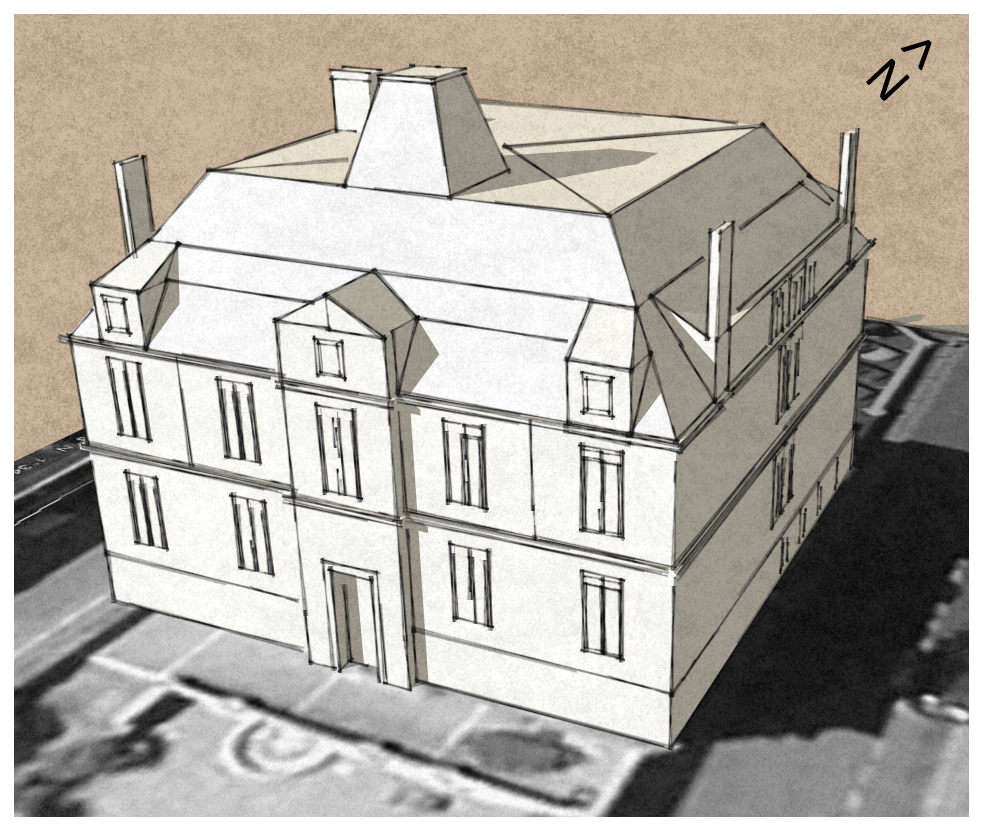
Let’s model it first using Sketchup. Also I have used a non standard style only for visualization purposes
Shadow analysis en Puerta de Arganda, Madrid.
Hoy publico en español puesto que los datos son en español y yo soy español:-) but if you guys have any doubt dont hesitate to ask… even if you are french I will be around to answer you back “en français”, quand même !!!. La idea era hacer un estudio de sombras de para mi propio usoContinue reading “Shadow analysis en Puerta de Arganda, Madrid.”
On va déménager alors… Analyse solaire !!!
Ma copine et moi on va nous déménager très bientôt alors il faut faire une analyse solaire. Nantes, la ville ou on habite est connue dans le monde entier pour ses niveaux de pluie, n’importe que ce soit été, printemps… meme si France Météo a dit qu’il va faire BEAU… A Nantes ça ne marcheContinue reading “On va déménager alors… Analyse solaire !!!”
Vulnérabilité de la population – Analyse SIG
Voici un ancien analyse accompli il y a long temps mais toujours d’actualité. En espagnol.
