Remote Sensing, Photogrammetry, Lidar and Landuse IGN Spain

teledeteccion-fotogrametria-lidar-usos-del-suelo-ign-20141118b

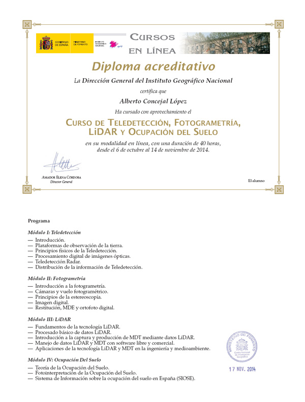
A few more lines for leting you know again that i passed this other course just now in Instituto Geográfico of Spain (IGN).

Remote Sensing, Photogrammetry, Lidar and Landuse, a comprehensive 40h update on relevant information i need tu use on a daily basis. This ‘update’ helps me to better understand what i am working with and this way, being able to properly describe it for my daily analysis,

Advertisement

Leave a Reply

Fill in your details below or click an icon to log in:

WordPress.com Logo

You are commenting using your WordPress.com account. Log Out /  Change )

Facebook photo

You are commenting using your Facebook account. Log Out /  Change )

Connecting to %s

%d bloggers like this: