Google Earth Engine and Dynamic World

Let me please introduce you this “new” LULC source I have come across with recently. The potential of this 10m “clutter” source is being able to acquire data from a few days ago instead of using outdated “very old” 2020 vintage datasets. I know if these days something 2020 is very old then myself, born in 1972 then i’m older than the riverside, older than peeing in a wall, even older than Methuselah. Yes, that’s the way it is nowadays.

Google Earth Engine is a geospatial processing service where you can perform geospatial processing at scale, powered by Google Cloud Platform. The purpose of Earth Engine is to:

Provide an interactive platform for geospatial algorithm development at scale
Enable high-impact, data-driven science
Make substantive progress on global challenges that involve large geospatial datasets

Wildfires in the sub-Saharan region

This image, acquired by one of the Copernicus Sentinel-2 on 8 February 2022, shows ongoing wildfires in the Boma National Park in South Sudan. Fires are common at this time of year in the sub-Saharan region.

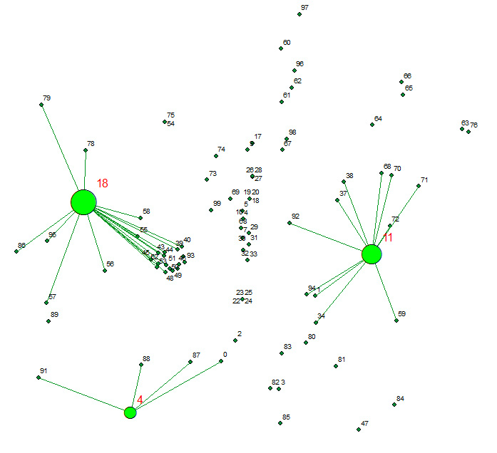
Allocation analysis: Attaching customers to facilities

Allocates a set of demand points (Customers) to user specified number of supply points (Facilities) out of a Facilities point dataset based on the Euclidian distance between the Customers and Facilities.

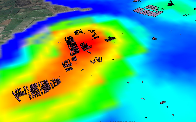
Réalisation du carte de densité pour vérifier Localisation des colonnes aériennes de Nantes Métropole

Localisation et caractéristiques des colonnes d’apport volontaire aériennes de Nantes Métropole utilisées pour la collecte des déchets. Outil de visualisation Global Mapper 17 Format SHP champ: VOLUME http://data.paysdelaloire.fr/donnees/detail/localisation-des-colonnes-aeriennes-de-nantes-metropole/ Ces colonnes sont implantées sur l’ensemble du territoire et sont destinées à la collecte du verre et des emballages recyclables (papier, carton, plastique). C’est genial jouer unContinue reading “Réalisation du carte de densité pour vérifier Localisation des colonnes aériennes de Nantes Métropole”

Creating value through Open Data

The benefits of Open Data are diverse and range from improved efficiency of public administrations, economic growth in the private sector to wider social welfare (Source: http://www.europeandataportal.eu/) Performance can be enhanced by Open Data and contribute to improving the efficiency of public services. Greater efficiency in processes and delivery of public services can be achieved thanks toContinue reading “Creating value through Open Data”

Comparación de DTM usando Global Mapper 17.0.1

Comparar, primero visualmente y después cuantitativamente dos DTM. Por un lado elegimos una fuente muy usual, SRTM con un DTM derivado de Fotogrametría Stereo.

Descargas del CNIG. Open Source bien hecho!

Hola amigos del GIS, Por motivos de trabajo que no vienen al caso, he tenido que bucear de manera sistemática la web de descargas del CNIG. http://centrodedescargas.cnig.es/CentroDescargas/inicio.do Una maravilla. Por motivos que tampoco viene al caso, he de hacer esto mismo de vez en cuando en todos los Institutos cartográficos del mundo y el delContinue reading “Descargas del CNIG. Open Source bien hecho!”

Change detection – Detección de cambios en polígonos

THE PROCEDURE: Centroids of buildings; Spatial join showing presence-absence, considering a 10m accuracy threshold, meaning if the centroid has not moved more than 10m, its the same building. If the centroid in 2012 is not in 2014, its considered as demolished. If a new centroid appears its considered new building.

DTM validation using Google Earth (and RMSE extraction)

Hi guys, Surfing the internet is great when you need to figure out something. I needed to validate some DTM from unknown sources against an also unknown source (but at least a kind of reliable one, Google Earth). All we need is Google Earth TCX converter ARcGIS Excel This is the procedure i have followed:Continue reading “DTM validation using Google Earth (and RMSE extraction)”

Using Excel to calculate the RMSE for LiDAR vertical ground control points

The height accuracy of the collected LiDAR data can be verified by comparing with independently surveyed ground control points on hard, flat, open surfaces. It is essentially just calculating the height differences for all the control points and then determining the height root mean squared error (RMSE) or differences. Most LiDAR processing software have the reporting function built-in. However, plain Microsoft Excel can also do the job (except for extracting the elevation from the LiDAR data).