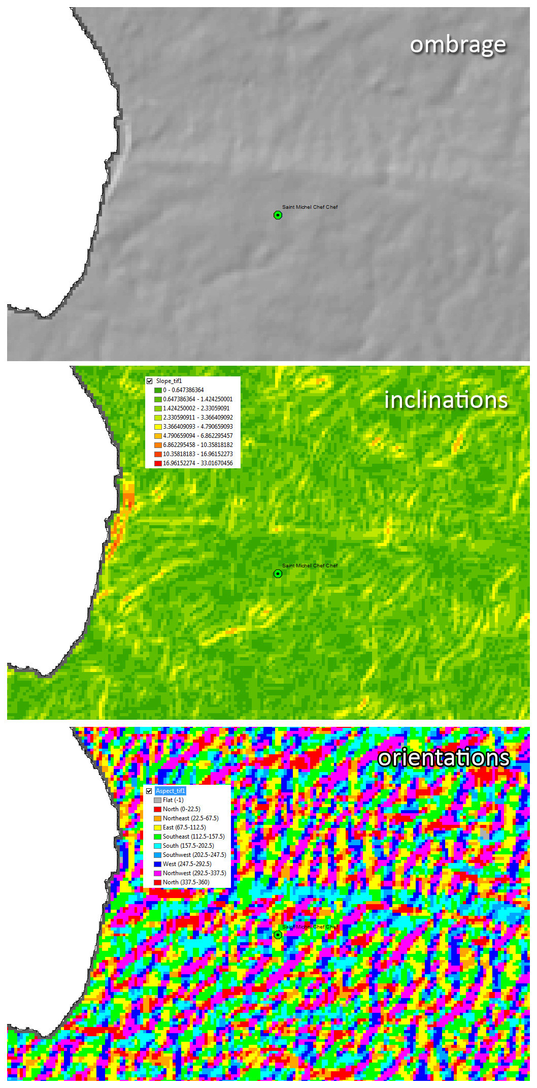
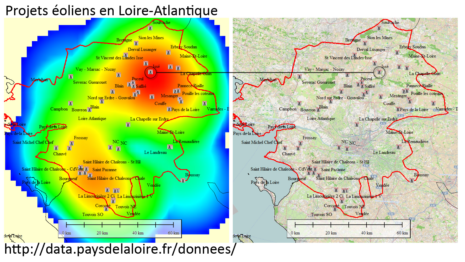
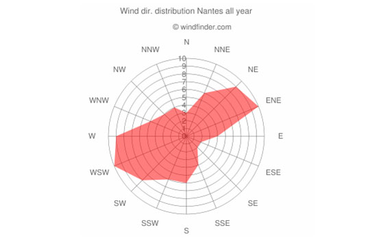
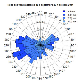
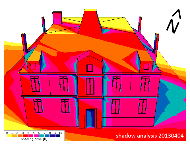
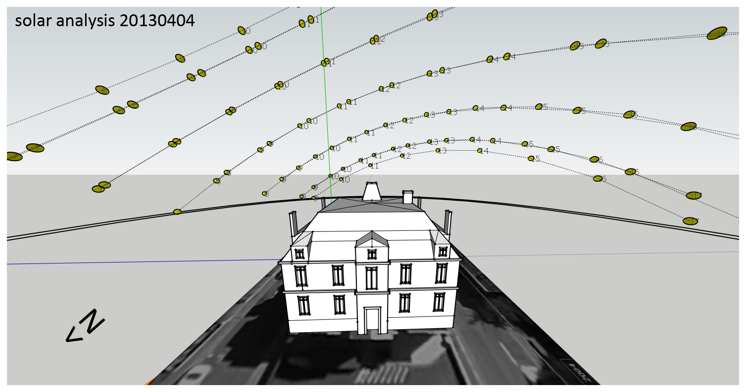
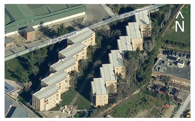
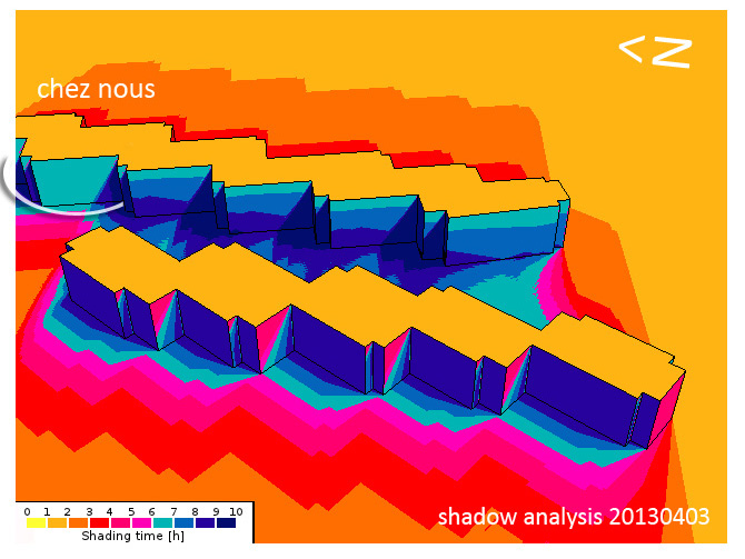
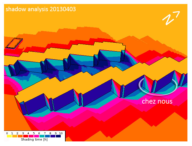
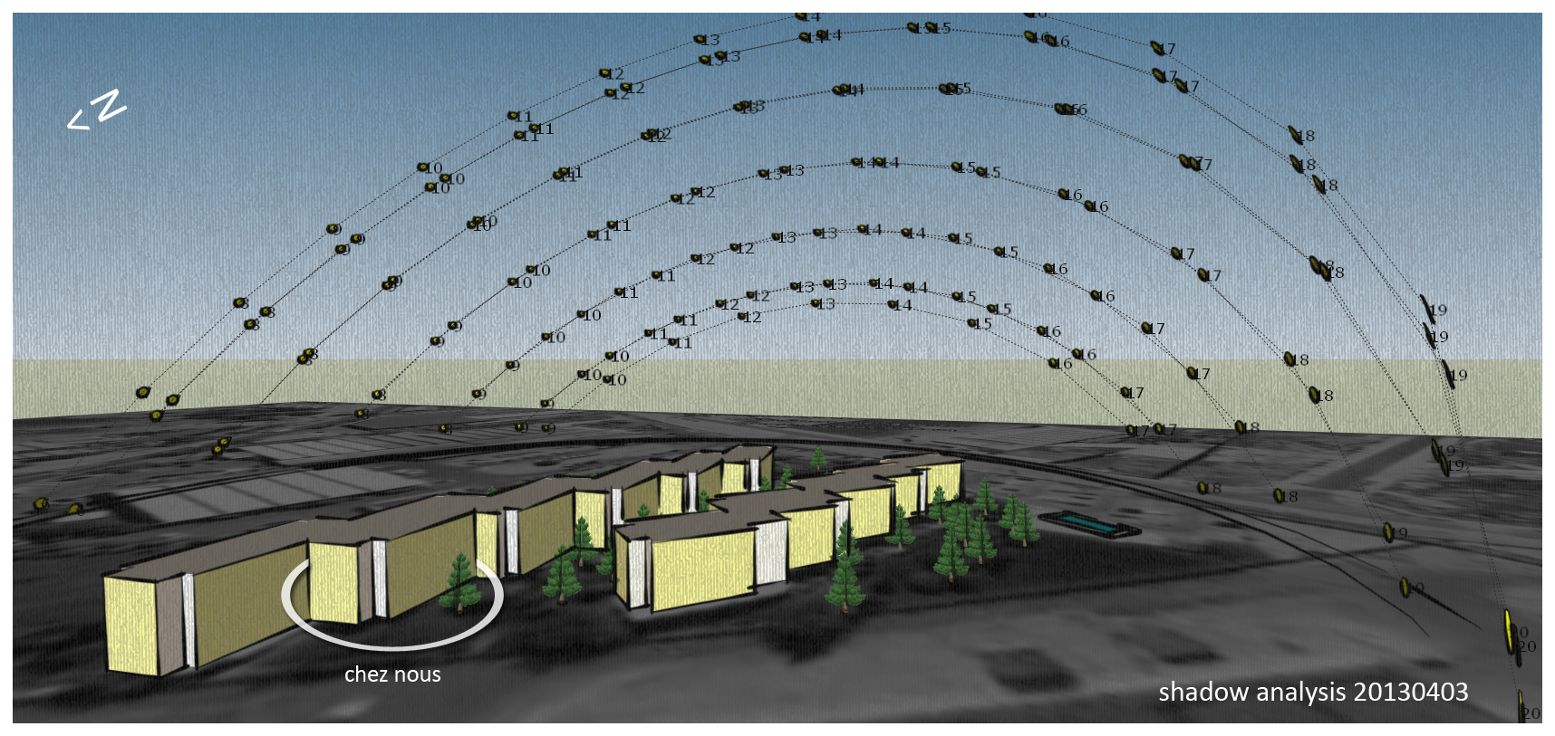
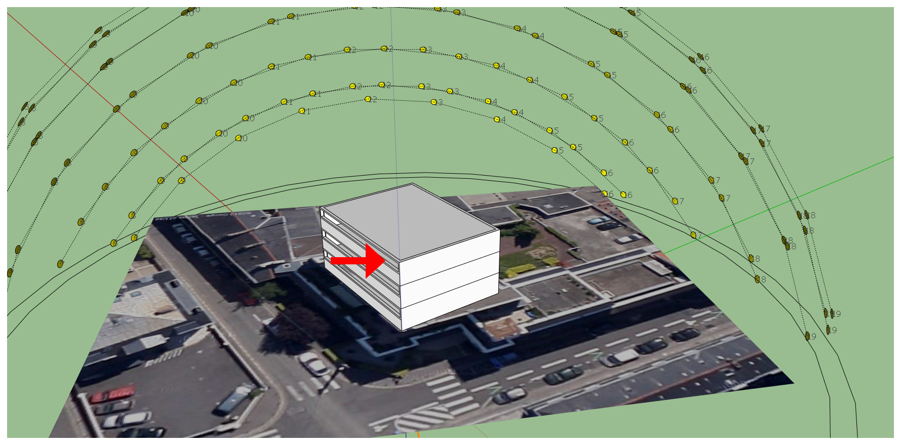
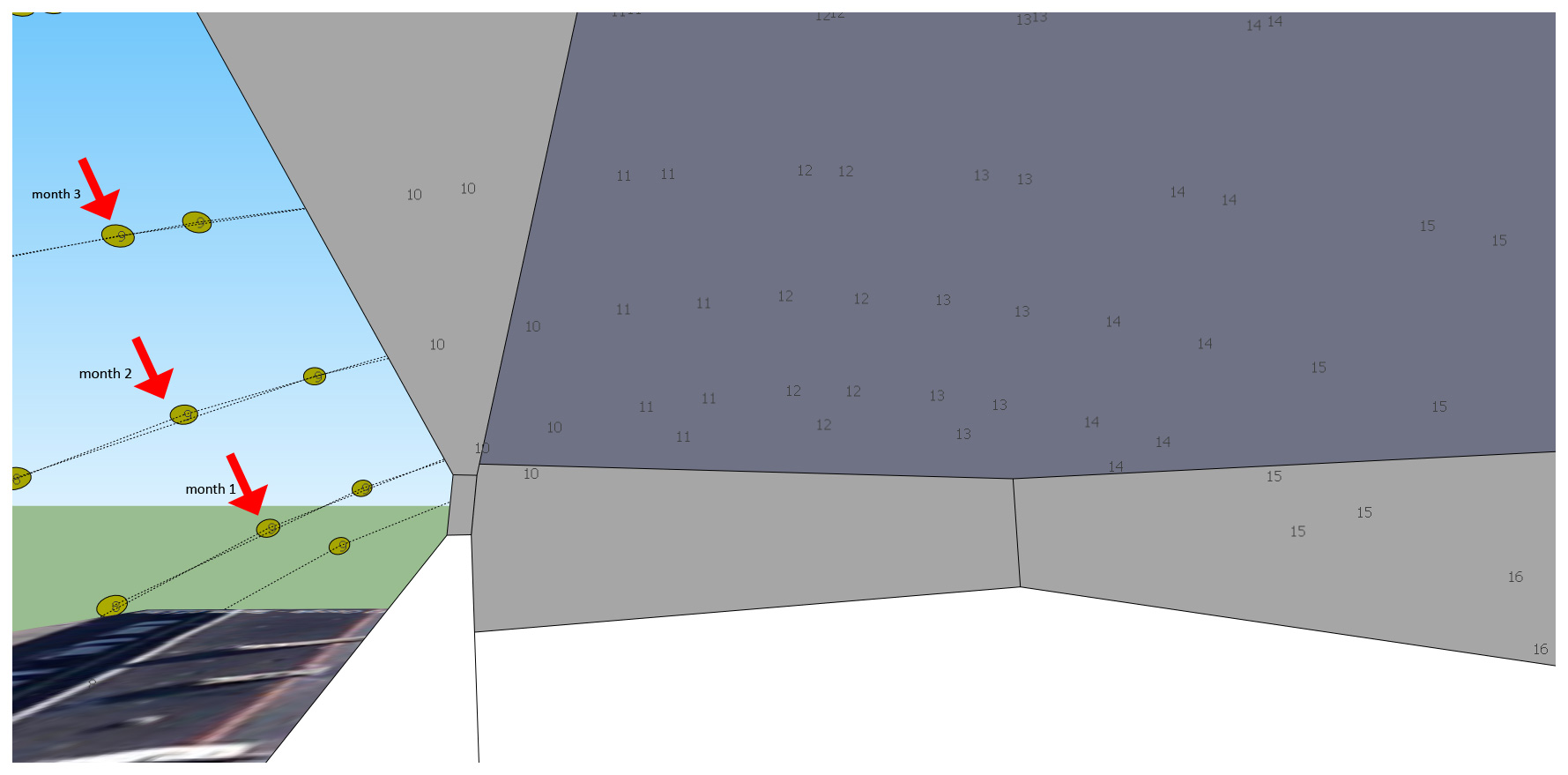
Ma copine et moi on va nous déménager très bientôt alors il faut faire une analyse solaire. Nantes, la ville ou on habite est connue dans le monde entier pour ses niveaux de pluie, n’importe que ce soit été, printemps… meme si France Météo a dit qu’il va faire BEAU… A Nantes ça ne marche pas comme ça. Il faut maximiser l’exposition pour garantir un montant minimum de lumière du soleil pendant l’année mais… comment faire?.
En rouge chez nous… on a pas encore trouvé notre nouvel appartement alors je vais faire l’analyse ici…
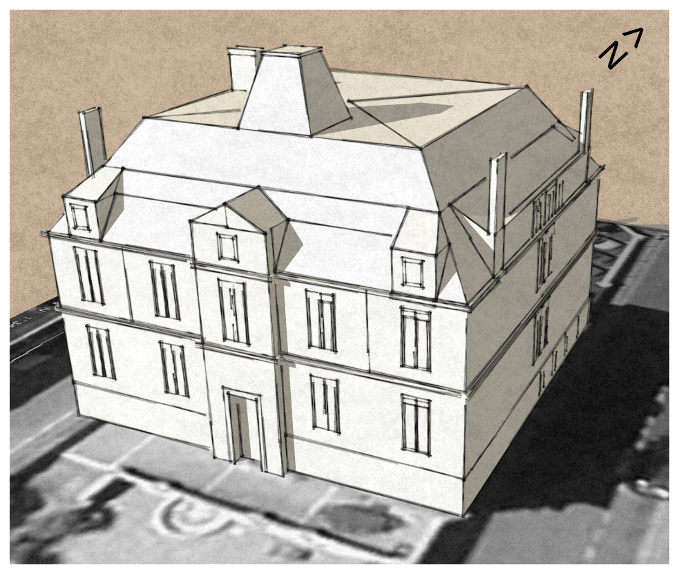
I started sketching this building across the street and decided to include some funny pseudo 3D pictures of my girlfriend and myself… Architectural modelling is easy using Sketch-up. This model took me about 5 hours work (during the weekend, shame!), using components, texturing, handling scenes and exporting/editing Video.
Un travailleur indépendant, ou travailleur autonome au Canada (en anglais freelancer) est à la fois entrepreneur, propriétaire (de ses moyens de production) et son propre employé. Il est maître de ses décisions concernant son travail mais doit toutefois s’adapter aux demandes de sa clientèle.
D’un point de vue étymologique, le mot freelance dérive de « free lance » qui est un terme médiéval pour désigner un mercenaire, un chevalier indépendant de tout seigneur et qui pouvait être « employé » pour accomplir une tâche.
Ce type de travailleur est très présent dans les économies de marché (agriculture, commerce, artisanat, professions libérales…) où il apporte souvent une voie de promotion sociale.
Les domaines parmi lesquels les travailleurs indépendants sont courants sont l’informatique, la communication, l’infographie, le conseil, la traduction, la formation, les postes d’attachés de presse ou attachés de relations publiques, etc.
En Europe, il existe quelques organisations de défense des travailleurs indépendants, plus ou moins reconnues par les instances européennes, qui jouent généralement un rôle de groupe de pression.
I have started using this visualization engine to overlay standard ortho imagery, DTM datasets and telecomunication specific datasets… All i can say so far is that it works pretty well!!!. Being able to understand the scope of land use dataset while we swipe different types of images… it works!!
In this particular case a land use classes menu was added so we can easily identify every one of the different types of coverages at the same time we visualize the background we have used to extract that information.
Please don’t hesitate to make questions about it,
Regards,
It was 2007 when i finished my master’s degree and wanted to show some videos of procedures. At that moment in time i wanted to find a job -any job- involving GIS and i finally found it dealing with the Geovisualization department within a GIS company… now i happen to deal with DEMs. DTM, etc on a daily basis which is great!!. I hereby show you that video.
The most efficient way to monitor our environment is from above. Traditionally, aerial photography and mapping is a costly and time consuming business. However, by using our UAV technology, we are able to offer a cost and time effective solution for your aerial photography and mapping needs. Obtaining high resolution Orthorectified image mosaics and Digital Elevation Models has never been this easy.
Q: Can the UAV fly in all weather conditions?
A: Technically, our UAV can fly with winds up to 7 m/s (i.e. moderate breeze), in low-visibility conditions, or even at night. Although light rain will usually not affect its flight characteristics, the swinglet is not water-proof and should therefore not be used when raining or snowing. For best image quality, the UAV should be used on clear days with light wind (up to 5 m/s, i.e. a normal breeze is fine).
Q: What are the specifications of the camera used in the UAV?
A: The UAV is equipped with a 12 MP compact camera with a focal length of 24 mm (in 35-mm equivalent). The resulting ground resolution is adjusted by choosing an appropriate flight altitude (typically between 50 and 1000 metres above ground) and will range from 2 to 40 cm/pixels.
Q: What is the area that can be typically imaged during one flight?
A: This depends on the flight altitude (and thus the ground resolution): At 140 m (ground resolution of 5 cm/pixel), one picture covers 0.03 square km (3 ha, 7 acres) and one flight covers up to 1.5 square km (150 ha, 370 acres). * At 280 m (ground resolution of 10 cm/pixel), one picture covers 0.12 square km (12 ha, 29 acres) and one flight covers up to 4 square km (400 ha, 990 acres). * At 840 m (ground resolution of 30 cm/pixel), one picture covers 1.07 square km (107 ha, 265 acres) and one flight covers up to 10 square km (1000 ha, 2470 acres).
Q:What are the flight performances of the UAV?
A: The UAV has a flight endurance of about 30 minutes with a fully charged battery. The endurance is reduced with wind, frequent altitude changes or very low temperatures. The cruise speed is 10 m/s (36 km/h, 22 mph). The climb rate is about 3 m/s. The maximum wind speed is 7 m/s (25 km/h, 16 mph), which corresponds to a moderate breeze. This includes a safety margin to allow the UAV to fly back home automatically when strong wind is detected by the autopilot.
Q: How many images can be taken during one flight?
A: When photos are triggered at maximum rate (every 3-4 seconds), the number of images in one flight can reach 400. The provided onboard memory card has more than enough space to store such a number of images at full resolution.
Q: What level of accuracy should be expected?
A: The accuracy of the orthomosaics and the digital elevation models (DEM) strongly depends on the flight height, lighting conditions, availability of textures, image quality, overlap, and type of terrain. In standard conditions (flying at 100-150 meters above natural terrains with 50 to 70% image overlap), a relative accuracy of 10 cm and an absolute accuracy of 3-5 meters is obtained without the use of Ground Control Points (GCP). However, GCP’s can be introduced, reducing the absolute error to the level of a few centimeters.
Good news!!!! They’ve probably released this Geovisualization Engine long time ago (It used to be an ‘in-house’ software) but I have just realized. I worked with this state-of-the-art TerrainView 3D software for six months while I was working as a GIS Specialist in Cape Town (South Africa)… What does this software has that no one of other softwares I know have????. Rain, snow, clouds, wind… Athmosferic conditions!!!! A very reliable package… I have just uploaded a video rendered directly from a pre-recorded flight path… I will try to make my own while I work with this personal license key they have provided me for one month… Here it is!!. Hope you like it mates!.
TerrainView™ is the free entry visualization product of ViewTec. TerrainView™is an easy to use viewing tool and 3d editor capable of displaying the most popular 3d formats. It offers walk-through capabilities in real-time.TerrainView Extensions
Upgrade the free TerrainView product online to the different professional extensions:
TerrainView-Globe™ extends TerrainView with unlimited GIS, multilayered elevation and image data import based on Earth and offers ultra-fast and high resolution rendering for GIS and simulation users.
The extension TerrainView-CMAX™ consists in a high-end system for seamless multi-channel, multi-projectionsand visualizations on multiple screens and walls.