A few more lines for leting you know again that i passed this other course just now in Instituto Geográfico of Spain (IGN). Remote Sensing, Photogrammetry, Lidar and Landuse, a comprehensive 40h update on relevant information i need tu use on a daily basis. This ‘update’ helps me to better understand what i am working with andContinue reading “Remote Sensing, Photogrammetry, Lidar and Landuse IGN Spain”
Tag Archives: 3d geovisualization
DTM from SRTM? Let’s compare sources using RMSE (Root Mean Square Error) and a gaussian kernell density map
I guess we all can make a DTM out of many sources but SRTM is one of the most common ones, right?. Then let’s learn from this very simple approach how close we are from the SRTM raw data. Selecting a not very big representative area to be able to handle it, exporting raster to polygon (fromContinue reading “DTM from SRTM? Let’s compare sources using RMSE (Root Mean Square Error) and a gaussian kernell density map”
Solar + Shadows analysis on Rue Massillon, Nantes (France)
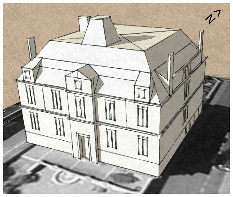
Let’s model it first using Sketchup. Also I have used a non standard style only for visualization purposes
Visualizing LAS LIDAR data with sketch-up
While trying to figure out the way to get a 3D model from raw Lidar data, I first opened my LAS file in Global Mapper, exported it to DXF, imported then into Sketch-up and after recording a few scenes, I saved the animation… this is it!. Alberto
Using Excel to calculate the RMSE for LiDAR vertical ground control points

The height accuracy of the collected LiDAR data can be verified by comparing with independently surveyed ground control points on hard, flat, open surfaces. It is essentially just calculating the height differences for all the control points and then determining the height root mean squared error (RMSE) or differences. Most LiDAR processing software have the reporting function built-in. However, plain Microsoft Excel can also do the job (except for extracting the elevation from the LiDAR data).
Data acquisition: How do I know if this river is been well acquired?
I’ve already entered my river but my imagery was in 2D so… was it well acquired?… First of all, I import my shape (shp) file into Global Mapper (what a great sofware!) and export my vector file as a KML. Import my river.kml file into my brand new Google Earth 5.2 or just double-click itContinue reading “Data acquisition: How do I know if this river is been well acquired?”
The SketchUp 3D API: Working with 3D geospatial data
I hereby post this video by Matt Lowrie (Google). hope it’s interesting for you guys. Alberto
GIS+Architectural scenaries. Awesome!
Even from scratch or from dgn/dxf vectorial format’s contour lines you create your own scenario. Then import your model previously created using Sketch-up (this time i used google’s 3d warehouse, thank you Dilbert). Stamp your house using sketch-up sandbox tools. Then fur your scenario as if it was grass… A little of photoshop like clouds andContinue reading “GIS+Architectural scenaries. Awesome!”
Map24.com; My favorite route planner!
My very good friend Fernando (a spanish/english like friend of mine:-)) introduced me this magnificent route planner he was using at that moment (three years ago!!!!)… map24.com had a very interesting 3D engine, very easy to use and very reliable… I’ve been using it since but it has never been one of the most famousContinue reading “Map24.com; My favorite route planner!”
Interesting: sketchup, more than a quick visualization tool.
I’ve extracted this information from the very interesting ‘Sketchup blog’ from Google… They talk about something I have always thought it could happen… Sketchup is not only a rapid visualization tool but a CAD like software with visuallization capabilities which in addition is integrated within a world wide used 3D scenary, perfect for Geovisualization andContinue reading “Interesting: sketchup, more than a quick visualization tool.”

