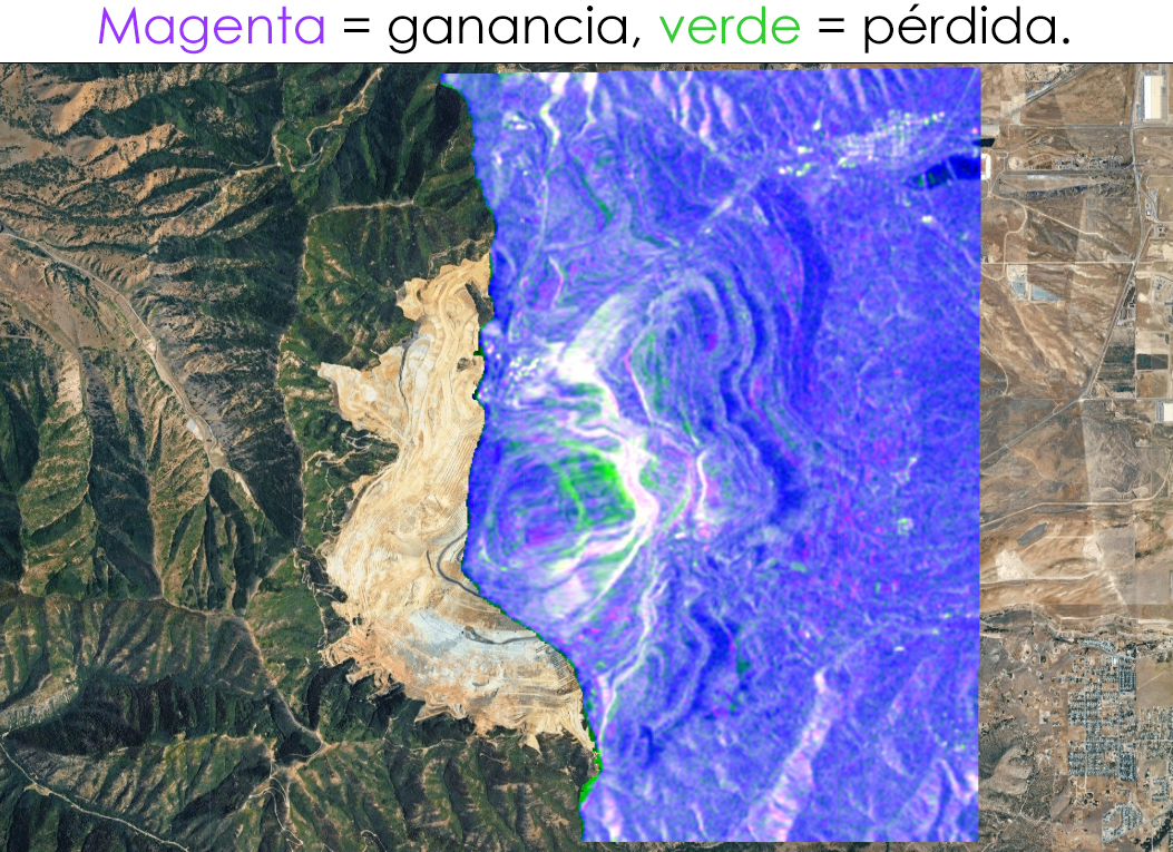
Análisis de cambios con SAR (Radar de Apertura Sintética) usando Sentinel-1 sobre la mina Bingham Canyon en Utah, donde ocurrió uno de los mayores deslizamientos de tierra de la historia minera el 10 de abril de 2013.
Tag Archives: us
Who Gets to See the War? Satellite Imagery Censorship and the Copernicus Alternative
A private company, operating under a US federal license, was effectively told by the Trump administration to go dark over an active war zone. Planet complied. Vantor and BlackSky — both heavily dependent on US defense revenue — said they hadn’t even received such a request, because they were already tightly controlling access. The selective pressure lands precisely on the most open, most commercially accessible provider. That is not a coincidence.A private company, operating under a US federal license, was effectively told by the Trump administration to go dark over an active war zone. Planet complied. Vantor and BlackSky — both heavily dependent on US defense revenue — said they hadn’t even received such a request, because they were already tightly controlling access. The selective pressure lands precisely on the most open, most commercially accessible provider. That is not a coincidence.
County of Scotland (North Carolina, US) GIS Cartography
One more video i recorded long ago on geoprocessing Cartography. Landuse, DTM, etc. Hope you like it.
