
In August 2014, I laced up my running shoes for the first time, with no grand expectations — just a simple desire to move, to feel better, to take control. I was far from athletic: weighing nearly 80 kilograms (almost 20 kg more than today), with no endurance, no rhythm, and definitely no running background (exception made of some runs in my mid 20’s :-)). But I made myself a promise: I would be stubborn, consistent, and patient. No matter the weather — rain, wind, snow, scorching heat, storms — I would run, three times a week, every week.
Tag Archives: GIS
GEOGRAFÍA EN EL COLEGIO!
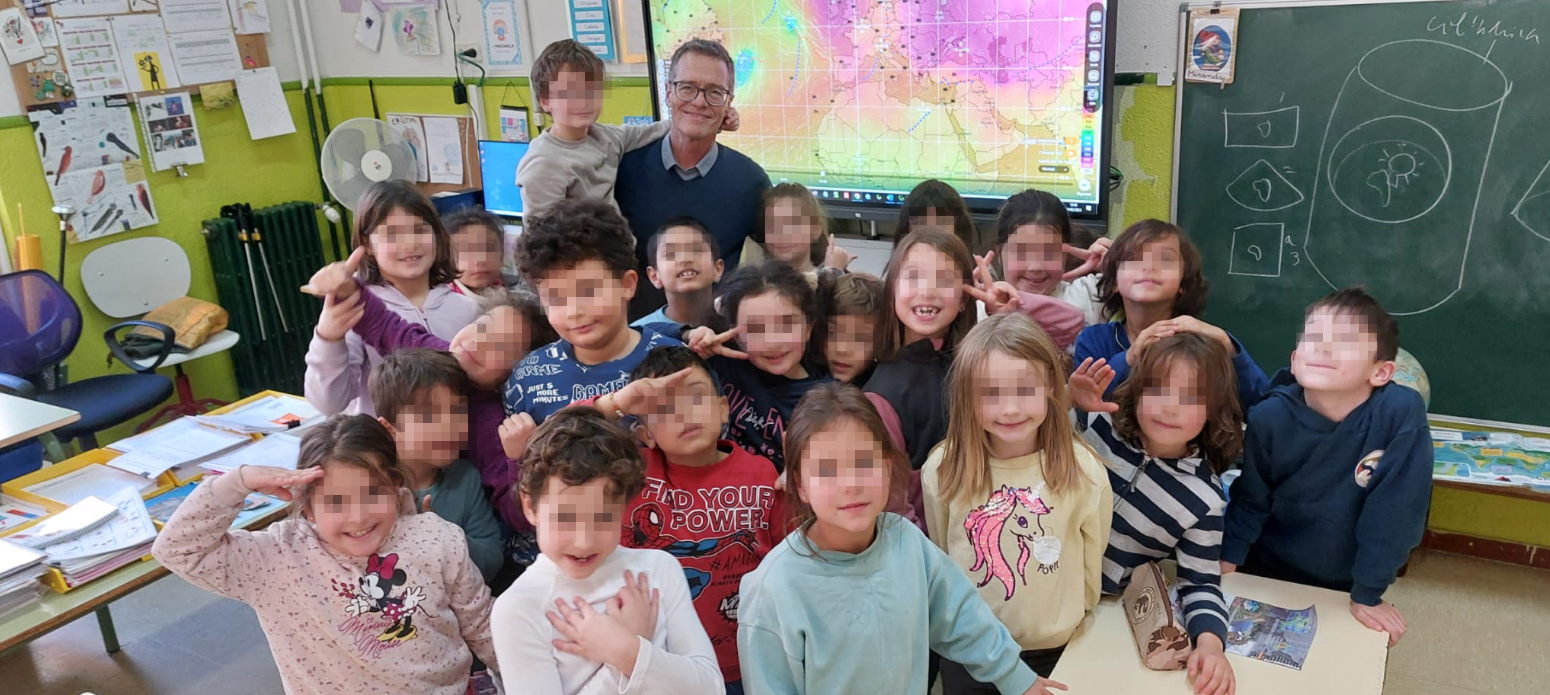
Ayer tuve el honor de compartir una hora y media con la clase de 2ºA de primaria del Colegio Ermita del Santo en Madrid, hablando sobre Geografía desde muchos puntos de vista. Desde las proyecciones cartográficas hasta Google Earth, pasando por un proyecto cartográfico real y reciente, y terminando con la relación entre la Geografía y la Meteorología. Pero lo más especial no fueron los mapas ni las explicaciones… ¡fueron las preguntas!
LOS ANGELES WILDFIRES 2025: Sentinel 2 +Overpass Turbo (OSM)

En Los Ángeles, la combinación de condiciones meteorológicas, como los vientos secos de Santa Ana y las altas temperaturas, crea un entorno propenso a incendios forestales. Estos fuegos, a menudo cercanos a áreas urbanas, representan un gran desafío para la gestión de emergencias. Aquí es donde Sentinel-2 se convierte en una herramienta crucial. Utilizando la combinación de bandas 12, 8, 4, Sentinel-2 permite detectar rápidamente focos de calor y evaluar la extensión de las áreas quemadas, lo que es vital para coordinar respuestas eficaces. Esta capacidad de monitoreo casi en tiempo real es fundamental para mitigar el impacto de los incendios y proteger tanto a las comunidades como a los ecosistemas.
Palestine 2023-2024

The 7th of October will forever be remembered in our collective memory as a day of tragedy and senseless violence, an operation that would shatter the dream of Israel’s inviolability. The attacks by Hamas were unequivocally condemnable. The targeting of civilians (+1200 dead and +250 kidnappings) is never acceptable, and those responsible for such acts must be held accountable. However, the response that followed has escalated into something far worse, a state-driven campaign of violence by Israel that has, in just one year, claimed over 42,000 lives, a staggering number of whom are women and children. This is not defense; this is mass murder. GENOCIDE.
Wildfires in Russia through SENTINEL 2

In recent days, the Sakha region in Russia has experienced significant wildfire activity, More than 100 wildfires spanning more than 300,000 hectares are currently active. driven by a combination of extreme weather conditions and environmental factors. The fires, which have spread across vast areas of forest and tundra, have been exacerbated by unusually high temperatures and prolonged periods of drought. These conditions have led to exceptionally dry vegetation, creating an ideal fuel for the fires.
I FORO NACIONAL: CIENCIAS DE DATOS ESPACIALES COMO HERRAMIENTA EFICAZ EN LA GESTION PUBLICA. Lima (Perú)

Esta pasada semana he tenido el honor de viajar a Lima (Perú) para participar en el el Primer Foro Nacional de Ciencias de Datos Espaciales como herramienta eficaz para la gestión pública estos pasados 18-19 Julio 2023 en el Centro de Convenciones de Lima, Perú. Mi ponencia era sobre el DIGITAL TWIN en la ciudad de CUZCO así como el BRIGHT EARTH CITY TEXTURING, una solución de texturización procedural con semántica 3D de bajo mantenimento de mi empresa Luxcarta, un gran adelanto tecnológico de nuestro departamento de I+D.
The beauty (and precision) of LIDAR:

Lidar, which stands for Light Detection and Ranging, is a technology that uses laser beams to measure distances and create detailed maps of the surrounding environment. It works by emitting laser pulses and then measuring the time it takes for the pulses to bounce back after hitting objects in their path. By analyzing the returning signals, lidar can accurately calculate the distance to various points and generate a three-dimensional map.
Learning to use GOES constellation

GOES satellites continually view the continental United States, Pacific and Atlantic Oceans, Central and South America, and Southern Canada. To fully cover Alaska, Hawaii, the entire continental United States and the Pacific and Atlantic Oceans (for tropical storms), NOAA operates two GOES satellites simultaneously
Maps and Art. AI dissertation

Consider the ancient maps that adorned the walls of explorers and cartographers. These maps, adorned with intricate illustrations and embellishments, captured not just the physical landscape, but also the spirit of discovery and wonder. They were an expression of human curiosity, a testament to our desire to venture into the unknown. These maps were not limited by the constraints of reality; instead, they became a visual representation of aspirations and dreams.
Measuring snow coverage using EOB – Earth Observation – Sentinel HUB
Playing with Sentinel 2 images I realized that the amount of snow this year has been very low compared to last winter. Here are a couple of images from January 2022 and 2023 of the Canfranc – Paticosa – Jaca area. One of the most interesting things about this EO browser is that in addition to a standard 2D visualisation, we can visualise in 3D. Here is an video example. Another interesting thing is to be able to quantify the snowfall. There is a snow classifier based on NSDI (Normalized Difference Snow Index, The Normalized Difference Snow Index (NDSI) snow cover is an index that is related to the presence of snow in a pixel and is a more accurate description of snow detection as compared to Fractional Snow Cover (FSC).
