Esta mañana encontré este interesante reportaje sobre el LIDAR (Laser Imaging Detection and Ranging, detección y localización de imágenes por láser) la tecnología con la que trabajo desde hace años y que a algunos les parece recién inventada, jeje.
Category Archives: clutter
Retirada de vehículos por la grúa municipal en Madrid: Una aproximación visual usando Datos Abiertos.

Solo estoy tomando en cuenta 185 puntos debido a las limitaciones de mi servidor de geocode https://www.mapdevelopers.com/batch_geocode_tool.php pero muestra que los datos tienen sentido, siendo el barrio de Sol el que concentra una densidad mayor de actuaciones de la grua municipal. Para el fondo, he usado una conexón WMS a OSM y geometrías de Barrios tomadasContinue reading “Retirada de vehículos por la grúa municipal en Madrid: Una aproximación visual usando Datos Abiertos.”
BGS Geology of Britain: Geovisualization 100%

Oh! a must see: BGS Geology of Britain. Source from http://www.bgs.ac.uk/discoveringGeology/geologyOfBritain/home.html Britain is fortunate in possessing a remarkably varied geology within a relatively small area. The rocks that make up our islands represent a long and complicated history of events. They encompass most of the major periods of geological time and extremes of climate from desert toContinue reading “BGS Geology of Britain: Geovisualization 100%”
Homicidio doloso en Ciudad de México 2013-2015

Recibí este link por Facebook hace un rato (Gracias Paco!)… https://hoyodecrimen.com/mapa#/19.4052/-99.0987/12 y me dediqué unos minutos a analizar un hecho puntual, el homicidio doloso, en un periodo concreto de tiempo, de 2013 a 2015. Veamos la previsualización de todos los homicidios ocurridos en 2013 en CARTO. El autor de la página llamada CRIMEN POR TUContinue reading “Homicidio doloso en Ciudad de México 2013-2015”
Réalisation du carte de densité pour vérifier Localisation des colonnes aériennes de Nantes Métropole

Localisation et caractéristiques des colonnes d’apport volontaire aériennes de Nantes Métropole utilisées pour la collecte des déchets. Outil de visualisation Global Mapper 17 Format SHP champ: VOLUME http://data.paysdelaloire.fr/donnees/detail/localisation-des-colonnes-aeriennes-de-nantes-metropole/ Ces colonnes sont implantées sur l’ensemble du territoire et sont destinées à la collecte du verre et des emballages recyclables (papier, carton, plastique). C’est genial jouer unContinue reading “Réalisation du carte de densité pour vérifier Localisation des colonnes aériennes de Nantes Métropole”
Change detection – Detección de cambios en polígonos

THE PROCEDURE: Centroids of buildings; Spatial join showing presence-absence, considering a 10m accuracy threshold, meaning if the centroid has not moved more than 10m, its the same building. If the centroid in 2012 is not in 2014, its considered as demolished. If a new centroid appears its considered new building.
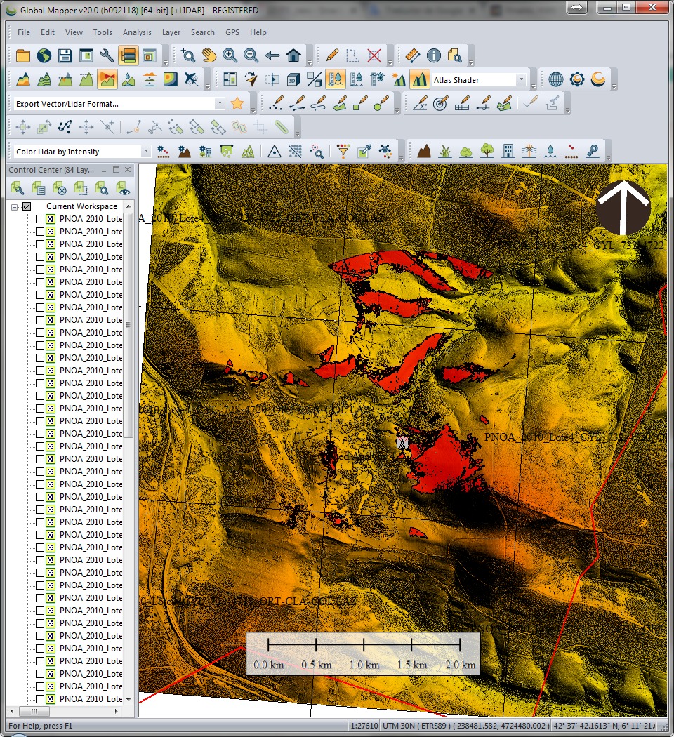
Remote Sensing, Photogrammetry, Lidar and Landuse IGN Spain
A few more lines for leting you know again that i passed this other course just now in Instituto Geográfico of Spain (IGN). Remote Sensing, Photogrammetry, Lidar and Landuse, a comprehensive 40h update on relevant information i need tu use on a daily basis. This ‘update’ helps me to better understand what i am working with andContinue reading “Remote Sensing, Photogrammetry, Lidar and Landuse IGN Spain”
