ESTIMATED GHSL vs INE 2025

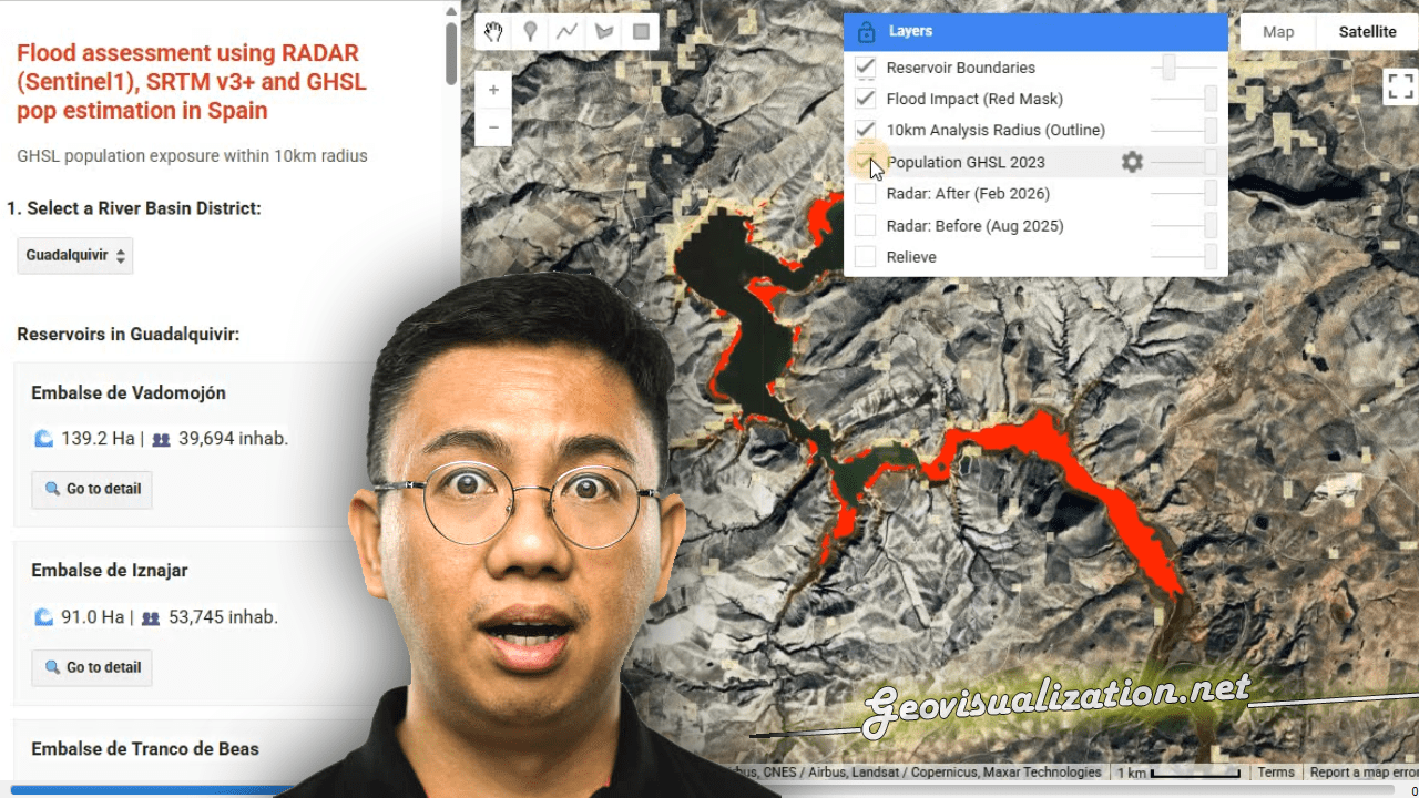
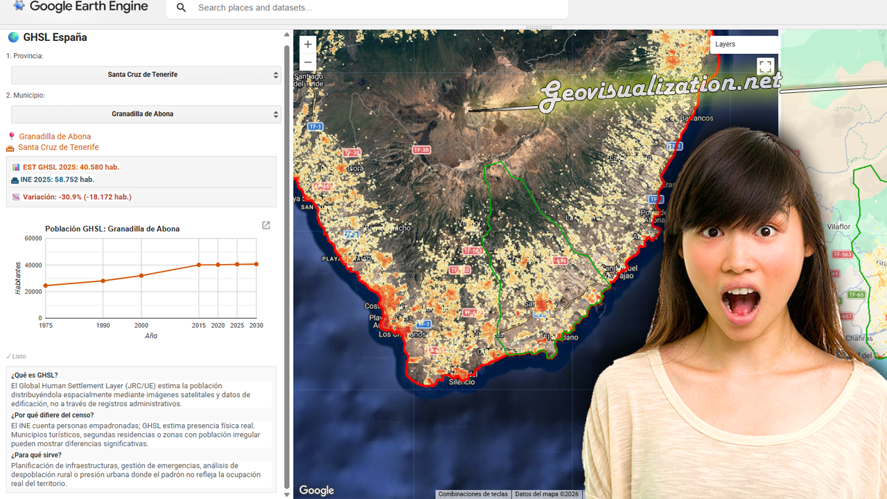
He desarrollado este COMPARADOR DE POBLACIÓN GHSL vs PADRÓN INE 2025 en JavaScript/Google Earth Engine que cruza estimaciones satelitales de población con los datos oficiales del censo español municipio a municipio.

La herramienta permite seleccionar cualquier provincia y municipio de España, visualizar la distribución espacial de población estimada por el GHSL con el último dato oficial del INE 2025, detectando municipios con alta presión turística, despoblación real o población no registrada.
Una aplicación directa para planificación de infraestructuras, gestión de emergencias o análisis de cohesión territorial donde el padrón no refleja la ocupación real del territorio.

Flood assessment using RADAR (Sentinel1), SRTM v3+ and GHSL pop estimation in Spain

I have developed this NRT FLOOD RISK ASSESSMENT monitor in GEE that merges the power of RADAR and GHSL to detect impact over POPULATIONS under any weather conditions.

You can use geospatial intelligence to quickly transform satellite data into critical decisions during climate emergencies. GIS technology driving global resilience!

From LIDAR USGS to DSM in a few lines of code. The magic of R

The USGS LiDAR Explorer, hosted via gishub.org, serves as a high-performance web gateway for interacting with the USGS 3D Elevation Program (3DEP) datasets. First thing, go to this GITHUB repository https://github.com/opengeos/maplibre-gl-usgs-lidar, download code for the project (code>download ZIP), get connected with RStudio, save new project and open a script window… It’s all set up!