
Decenas de medios y redes sociales, algunos poco fiables por incapaces o partidistas (o las dos cosas), muchos datos, no necesariamente bien extraídos y analizados, varios criterios no harmonizados y cambiantes (en los últimos días dos veces han cambiado los criterios del Ministerio de Sanidad español!) me convencieron para hacer los análisis yo mismo pero esto, claro, requiere un poco de tí. Los periodistas no tienen por qué tener nociones de estadística o de análisis espacial pero yo sí. Tengo acceso a OPEN DATA (Datos Abiertos) y ganas de análisis? Vamos a ver qué sale de esto.
Category Archives: análisis
Census differential Privacy Exploration: the change in population for every Congressional district after applying Differential Privacy
How differences in population count could have implications for service provision, allocation of funds, & political representation. Source: https://www.caliper.com/census-differential-privacy-maps/ The U.S. Census Bureau has changed the way it ensures privacy for the 2020 Census. The new method is called Differential Privacy (DP). To help people assess some of the implications and unintended consequences of Differential Privacy, Caliper® is providing severalContinue reading “Census differential Privacy Exploration: the change in population for every Congressional district after applying Differential Privacy”
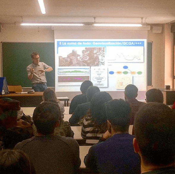
Mi ponencia en la #CESRI19. SWOC: Innovar para sobrevivir a la 4ª Revolución Industrial
Pasar del ‘hype’ a los hechos cuando hablamos de innovación es un gran reto en cualquier organización, pero más si cabe en las más grandes. En esta mesa contaremos con profesionales experimentados de diferentes organizaciones que están realizando proyectos reales que combinan tecnologías emergentes con geolocalización. Además de hacer un breve repaso a algunos deContinue reading “Mi ponencia en la #CESRI19. SWOC: Innovar para sobrevivir a la 4ª Revolución Industrial”
Google Earth Engine y los incendios de verano: el caso de Cadalso de los Vidrios, Madrid (Julio 2019)

Gracias a la inestimable ayuda de mi compi de co-working Pablo Martín -ingeniero Forestal- con Google Earth Engine hemos modelado este NBR (Normalized Burn Ratio) que usa los canales NIR y SWIR de Sentinel-2 para medir la severidad del incendio de la semana pasada en mi pueblo, Cadalso de los Vidrios (Madrid, España). Rozamos la tragedia en lo personal pero sin duda fue terrible a nivel material. Tardaremos décadas en revertir este funesto incendio…
Crean un mapa de los bosques de toda la Tierra con una resolución de 50 metros

Los bosques son los pulmones de la Tierra. Contrarrestan el calentamiento global al tiempo que brindan protección y recursos para los seres humanos, los animales y las plantas. Son un tesoro natural, pero se pierden a un ritmo alarmante, especialmente desde mediados del siglo XX. Para monitorear, evaluar y proteger este órgano verde con precisión,Continue reading “Crean un mapa de los bosques de toda la Tierra con una resolución de 50 metros”
Solar Radiation Analysis test over Madrid using Open Data

Incoming solar radiation (insolation) received from the sun is the primary energy source that drives many of the earth’s physical and biological processes. Understanding its importance to landscape scales is key to understanding a broad range of natural processes and human activities. Taking advantage of official Open Data sources (Cadastre footprints and CNIG mainly) IContinue reading “Solar Radiation Analysis test over Madrid using Open Data”
Seminario motivacional en el Máster Tecnologías de la Información Geográfica de la UAH
Esta vez me tocó impartir el seminario motivacional “Geógrafos en tiempos de GIS” en el entorno del Máster de Tecnologías de la Información Geográfica. Yo encantado pues este mismo máster lo cursó yo hace ya doce años (wow, time flies, el tiempo pasa rápidamente cómo dicen!) y la verdad es que me encantó hacerlo.
Seminarios motivacionales para (quizá) futuros Geógrafos

La idea era mostrar el día a día del trabajo de un Geógrafo cualquiera (yo) y el recorrido que me ha llevado hasta aquí. El porqué de la elección de la carrera, los diferentes trabajos, las influencias de otros trabajos a priori sin conexión, el día a día actual, etc.
+53,000 visits from 166 countries!!

This is just for leting you guys know i have received visits from almost all over the world
Análisis de la inundación en Sant Llorenç des Cadassar (Baleares, España) en Octubre 2018

Esta simulación con datos reales permite constatar empíricamente la pésima ubicación del pueblo en medio del cauce de un torrente al mismo tiempo que muestra lo osado de no gastar el dinero suficiente en infrastructuras que salven la vida de los habitantes de un entorno potencialmente peligroso en situaciones de borrascas ocluídas (gotas frías) o ciclogénesis expansivas, tan comunes en esta epoca del año por esta zona.
