
Incoming solar radiation (insolation) received from the sun is the primary energy source that drives many of the earth’s physical and biological processes. Understanding its importance to landscape scales is key to understanding a broad range of natural processes and human activities.
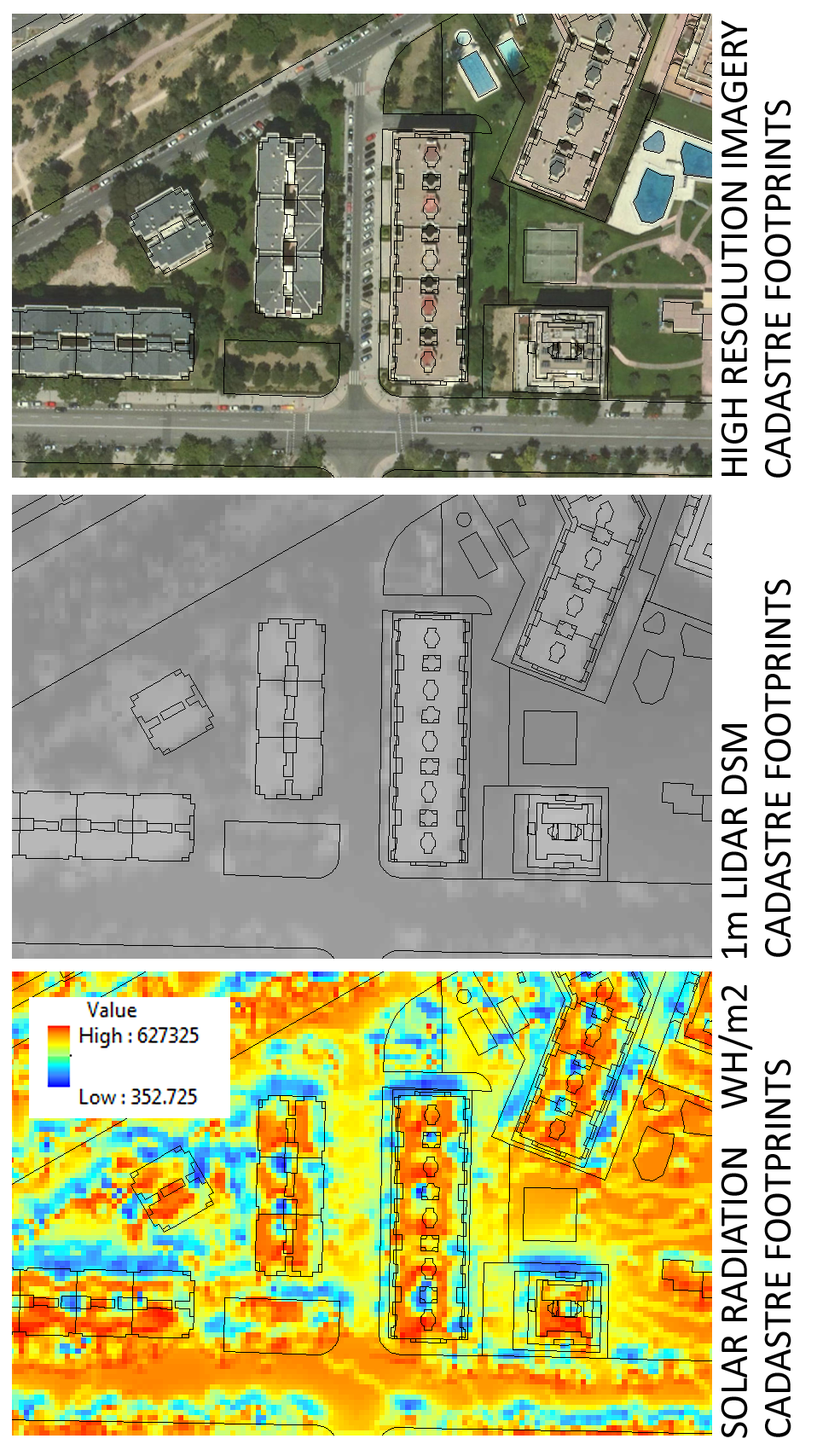
Taking advantage of official Open Data sources (Cadastre footprints and CNIG mainly) I haver performed a preliminary solar radiation analysis test over Madrid.
With landscape scales, topography is a major factor that determines the spatial variability of insolation. Variation in elevation, orientation (slope and aspect), and shadows cast by topographic features all affect the amount of insolation received at different locations. This variability also changes with time of day and time of year and in turn contributes to variability of microclimate including factors such as air and soil temperature regimes, evapotranspiration, snow melt patterns, soil moisture, and light available for photosynthesis.
Global radiation (Globaltot) is calculated as the sum of direct (Dirtot) and diffuse (Diftot) radiation of all sun map and sky map sectors, respectively.
Globaltot = Dirtot + Diftot
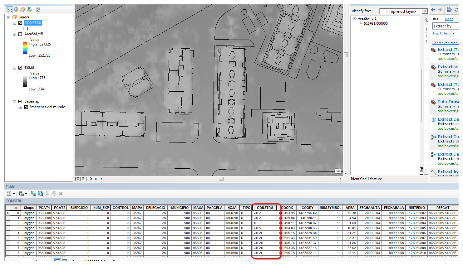
This raster results below shows WH/m2 over certain period of time and can be esaily spatially joined to a vector geometry.
It makes more sense the higher the resolution.
These analysis of Solar Radiation are fashionable due to the raise of Smart Cities. Do you want me to perform a little test over?. I herewith copy a very interesting Solar analysis over a single block of buildings using Autodesk software.
Also please take a look at some of my old links on these regards.
https://geovisualization.net/2013/04/04/solar-shadows-analysis-on-rue-massillon-nantes-france/
https://geovisualization.net/2013/04/03/shadow-analysis-en-puerta-de-arganda-madrid/
I guess you have more than enough to start with. Right?. Let me know if you guys have some doubts!
Alberto
MSc GIS and Remore Sensing
Sources: Own elaboration, https://pro.arcgis.com/en/pro-app/tool-reference/spatial-analyst/understanding-solar-radiation-analysis.htm, https://pro.arcgis.com/en/pro-app/tool-reference/spatial-analyst/how-solar-radiation-is-calculated.htm
