The USGS LiDAR Explorer, hosted via gishub.org, serves as a high-performance web gateway for interacting with the USGS 3D Elevation Program (3DEP) datasets. First thing, go to this GITHUB repository https://github.com/opengeos/maplibre-gl-usgs-lidar, download code for the project (code>download ZIP), get connected with RStudio, save new project and open a script window… It’s all set up!
Tag Archives: laz
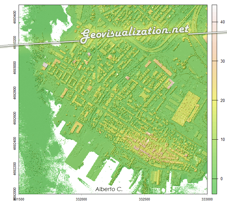
LIDAR Madrid LAZ 20cm

Ya van varias veces en el último mes que alguien no especialista en temas geográficos-cartográficos me habla de ‘ese sistema’ de láser para saber ‘la altura del terreno’ y es que la verdad es que LIDAR parece magia. Es bastante increible que pase un avión con una tecnología invisible a ojos humanos y que seContinue reading “LIDAR Madrid LAZ 20cm”
