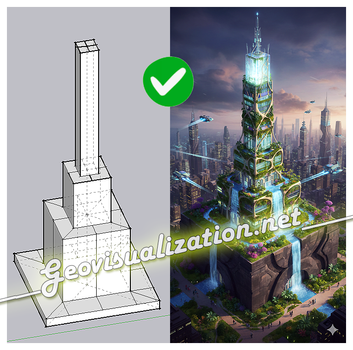
The exercise shows how a simple SketchUp 3D volume, defined solely by its basic geometry, can be transformed into a complex architectural proposal. Starting from the initial schematic model, the system interprets proportions, levels, and shapes, and converts them into a fully developed building, complete with textures, vegetation, lighting, and an urban context
Tag Archives: google
The SketchUp 3D API: Working with 3D geospatial data
I hereby post this video by Matt Lowrie (Google). hope it’s interesting for you guys. Alberto
